What is recorded here
Situated in a hollow on an undulating landscape. Aerial photograph (CUCAP: BGM, 53) shows what appears to be the cropmark of a circular enclosure (diam. c. 50m) defined by a single narrow fosse feature. The nature of this enclosure is not clear, and it has not become visible on other aerial images.
From the National Monuments Service (Archaeological Survey of Ireland) record ME008-033
The monument record does not grant public access. Check the route and ask the landowner before entering private land.
- What survives
- Recorded monument
Places near here
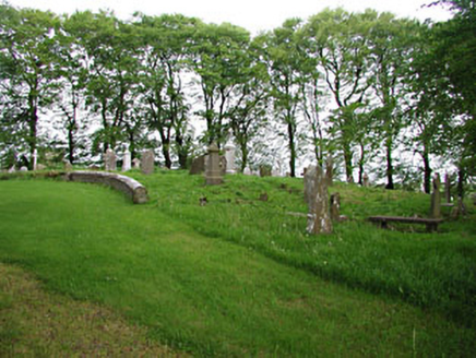 graveyard/cemetery275 yd
 European Beech282 ydEcclesiastical enclosure in Moat (fore By.)Ecclesiastical enclosure · 312 yd
 mill (water)1726 yd
 CastleCastle, motte and bailey · 1.6 miMount FortuneMountain / peak · 2.1 mi
 Mullaghmeen ForestPicnic place · 2.2 mi
 MoatCastle, motte · 3.5 mi
 European Yew3.6 mi
 LoughcrewMegalithic tomb cemetery · 4.0 mi
 Hag's ChairArchaeological place · 4.6 mi
 Slieve Na CalliaghMountain / peak · 4.6 mi
Pictures: National Inventory of Architectural Heritage; Malene Thyssen, Wikimedia Commons · CC BY-SA 3.0; Kieran Campbell, Geograph · CC BY-SA 2.0; Britishfinance, Wikimedia Commons · CC BY-SA 4.0; Mike Searle, Geograph · CC BY-SA 2.0; Sitomon, Wikimedia Commons · CC BY-SA 2.0; John M, Wikimedia Commons · CC BY-SA 2.0; James Fergusson, after E. Conwell, Wikimedia Commons · Public domain; Bill Griffiths, Wikimedia Commons · CC BY-SA 2.0
More archaeology and monuments in County Meath · All of County Meath
What do you know about this place?