
What is recorded here
From the National Monuments Service (Archaeological Survey of Ireland) record TN017-067002
Places near here
Photo credits
- Maker not stated on source page, www.tripadvisor.ie
- Maker not stated on source page, en.wikipedia.org
- Maker not stated on source page, commons.wikimedia.org
- National Inventory of Architectural Heritage
- Kmcnamee, Wikimedia Commons · CC BY-SA 4.0
- GerardM, Wikimedia Commons · CC BY-SA 2.1 es
 Castle in ruinsCastle, tower house · 21 yd
Explorer Tom Castle in Bawnmadrum ended up in the wrong place because it got turned around at the fork. It’s a ruined tower house…
 Fairy fort / earthen ringfort in BoolareaghFairy fort / earthen ringfort · 1.0 mi
Explorer Tom Fairy fort / earthen ringfort in Boolareagh would describe itself as 'a bit rough around the edges' if it could talk.…
Fairy fort / earthen ringfort in BoolabaunFairy fort / earthen ringfort · 1.1 miExplorer Tom Fairy fort / earthen ringfort in Boolabaun is stuck in a dispute over parking rights with a very stubborn fairy. It was…
 Linear earthwork in BoolareaghLinear earthwork · 1.1 mi
Explorer Tom Linear earthwork in Boolareagh is invisible except on an aerial photo taken in 1996 by a guy named Michael. Its New…
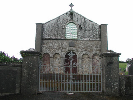 Saint Patrick's Catholic ChapelChurch/chapel · 1.1 mi
Explorer Tom Saint Patrick's Chapel in Shanballynahagh hates the road leading to it because it keeps arriving late. The old church…
 The RectoryRectory/glebe/vicarage/curate's house · 1.3 mi
Explorer Tom The Rectory in Cappalahan has bay windows and parapets that make it look like a Victorian doll’s house gone wrong. It…
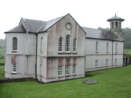 Christ Church (Corbally)Mill (water) · 1.4 mi
Explorer Tom Christ Church in Corbally is having a dramatic standoff with the nearest tree, which keeps trying to claim its…
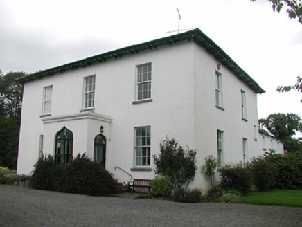 Aghsmear HouseHouse · 1.9 mi
Explorer Tom Aghsmear House in Aghsmear is proud of its ogee arches and thinks they’re the bee’s knees. The gates are crafted by…
 Killough GraveyardGraveyard · 4.2 mi
Explorer Tom A tragic love story ended badly next to Killough Graveyard when a suitor proposed during a thunderstorm and got struck…
 Ballyskenagh GAA pitchGAA ground · 5.8 mi
 Mapped cemeteryCemetery · 6.2 mi
Explorer Tom Mapped cemetery in County Offaly is incredibly proud of its one perfectly straight row of headstones. It’s the only…
 White Mulberry6.4 mi
Explorer Tom White Mulberry in County Offaly claims to have hosted a royal visit that nobody can prove ever actually happened. The…
More archaeology and monuments in County Tipperary · All of County Tipperary

What do you know about this place?Tap to add a comment or ask a question