What is recorded here
Situated on poorly drained land with shoreline of Lough Gowna 100m to NW and 110m to SE. Area known locally as 'Tiraneese' as annotated on OS 6-inch map. Outline of circular shaped area (approx. diam. 30m) enclosed by an earthen bank is clearly visible on Digital Globe aerial photograph. The circularity of the monument and the lack of an enclosing element on the NW side may suggest that this is a post-1700 designed landscape feature rather than that of a ringfort.
Situated on poorly drained land with shoreline of Lough Gowna 100m to NW and 110m to SE. Area known locally as 'Tiraneese' as annotated on OS 6-inch map. Outline of circular shaped area (approx. diam. 30m) enclosed by an earthen bank is clearly visible on Digital Globe aerial photograph. The circularity of the monument and the lack of an enclosing element on the NW side may suggest that this is a post-1700…
From the National Monuments Service (Archaeological Survey of Ireland) record LF006-079
The monument record does not grant public access. Check the route and ask the landowner before entering private land.
- What survives
- Recorded monument
Places near here
IndicatedCrannog · 805 ydCornamucklagh WoodlandWood · 987 ydCornagranMountain / peak · 1340 ydScrabby IslandIslet · 1584 ydCloone HouseCastle, unclassified · 1702 yd LaureldaleHouse · 1.0 miLough Gowna Church of Ireland ChurchChurch/chapel · 1.1 miMulrick WoodlandForest · 1.2 miAghaveansMountain / peak · 1.3 miWhite IslandIslet · 2.1 miPortal tomb in AghnacliffPortal tomb · 2.9 miCastleBawn · 3.3 mi
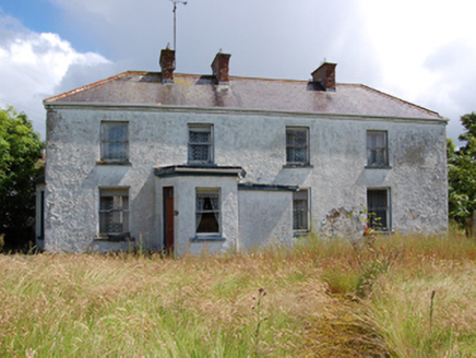 LaureldaleHouse · 1.0 mi
 Lough Gowna Church of Ireland ChurchChurch/chapel · 1.1 miMulrick WoodlandForest · 1.2 miAghaveansMountain / peak · 1.3 miWhite IslandIslet · 2.1 mi
 Portal tomb in AghnacliffPortal tomb · 2.9 miCastleBawn · 3.3 mi
Pictures: National Inventory of Architectural Heritage; Oliver Dixon, Geograph · Creative Commons Attribution-ShareAlike 2.0; Wanfried-Dublin, Wikimedia Commons · CC BY-SA 4.0
More archaeology and monuments in County Longford · All of County Longford
What do you know about this place?