What is recorded here
Located on a gentle SE-facing slope on the E side of the Monavullagh Mountains. Circular area (diam. 46.3m N-S; 45m E-Wm) defined by an overgrown earth and stone bank (Wth c. 5-6m; int. H 1.9-2.4m; ext. H 1.9-2.4m), with an outer fosse (at N: Wth of top 6m; Wth at base 2m; ext. D 0.5m) SW-ENE. The fosse is obscured by field-spoil SW-NW and an outer field bank survives SW-N. The possible original entrance (Wth 3.7m) is at E. Topsoil from the interior has been removed and the area is now used as a silage pit.
Located on a gentle SE-facing slope on the E side of the Monavullagh Mountains. Circular area (diam. 46.3m N-S; 45m E-Wm) defined by an overgrown earth and stone bank (Wth c. 5-6m; int. H 1.9-2.4m; ext. H 1.9-2.4m), with an outer fosse (at N: Wth of top 6m; Wth at base 2m; ext. D 0.5m) SW-ENE. The fosse is obscured by field-spoil SW-NW and an outer field bank survives SW-N. The possible original entrance (Wth…
From the National Monuments Service (Archaeological Survey of Ireland) record WA023-017
This remains an important historical record, but the official description says the monument is no longer visible or has been destroyed. The monument record does not grant public access. Check the route and ask the landowner before entering private land.
- What survives
- No visible remains or recorded as destroyed
Places near here
Photo credits
- National Inventory of Architectural Heritage
- Stephan van Helden, Wikimedia Commons · CC BY-SA 4.0
- Audrius Janecka, Wikimedia Commons · CC BY-SA 4.0
- Oliver Dixon, Geograph · CC BY-SA 2.0
- Colin Park, Geograph · CC BY-SA 2.0
- Slamforeman, Wikimedia Commons · CC BY 4.0
- BrendanLacey72, Wikimedia Commons · CC BY-SA 4.0
Enclosure in Carrigeennageragh BigEnclosure · 574 yd Mount KennedyHouse · 1044 ydfarm house1172 ydCliff-edge fort in CarrigmoornaCliff-edge fort · 1389 ydBawn in BarnankileBawn · 1693 ydHorse-chestnut3.1 miDungarvan CastleCastle · 5.1 miDungarvan Castle (in Ruins)Castle, Anglo-Norman masonry castle · 5.1 miGrattan SquareVisitor information · 5.2 miWaterford County MuseumMuseum · 5.2 miCunnigar PointHeadland · 5.3 miMaster McGrathMemorial · 5.7 mi
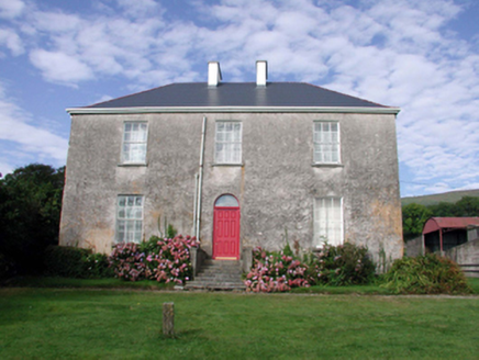 Mount KennedyHouse · 1044 yd
 farm house1172 ydCliff-edge fort in CarrigmoornaCliff-edge fort · 1389 ydBawn in BarnankileBawn · 1693 yd
 Horse-chestnut3.1 mi
 Dungarvan CastleCastle · 5.1 mi
 Dungarvan Castle (in Ruins)Castle, Anglo-Norman masonry castle · 5.1 mi
 Grattan SquareVisitor information · 5.2 mi
 Waterford County MuseumMuseum · 5.2 mi
 Cunnigar PointHeadland · 5.3 mi
 Master McGrathMemorial · 5.7 mi
More archaeology and monuments in County Waterford · All of County Waterford
What do you know about this place?