What is recorded here
Marked only on the 1927 ed. of the OS 6-inch map as an oval embanked enclosure (ext. dims. c. 37m N-S; c. 33m E-W), and situated on a broad plateau with the Dalligan River c. 400m to the W. D-shaped, grass-covered area (int. dims. 22m N-S; 17m E-W) with some bushes defined by a stone spread (Wth 4-5m; H 0.3-0.9m). The straight side (L c. 15m) is at E, but there is no evidence of a stone-facing. The entrance (Wth 4m) is at S.
Marked only on the 1927 ed. of the OS 6-inch map as an oval embanked enclosure (ext. dims. c. 37m N-S; c. 33m E-W), and situated on a broad plateau with the Dalligan River c. 400m to the W. D-shaped, grass-covered area (int. dims. 22m N-S; 17m E-W) with some bushes defined by a stone spread (Wth 4-5m; H 0.3-0.9m). The straight side (L c. 15m) is at E, but there is no evidence of a stone-facing. The entrance (Wth…
From the National Monuments Service (Archaeological Survey of Ireland) record WA023-018
The monument record does not grant public access. Check the route and ask the landowner before entering private land.
- What survives
- Recorded monument
Places near here
Photo credits
- National Inventory of Architectural Heritage
- Stephan van Helden, Wikimedia Commons · CC BY-SA 4.0
- Audrius Janecka, Wikimedia Commons · CC BY-SA 4.0
- Oliver Dixon, Geograph · CC BY-SA 2.0
- Colin Park, Geograph · CC BY-SA 2.0
- Slamforeman, Wikimedia Commons · CC BY 4.0
- BrendanLacey72, Wikimedia Commons · CC BY-SA 4.0
Embanked enclosureFairy fort / earthen ringfort · 574 ydCliff-edge fort in CarrigmoornaCliff-edge fort · 1036 yd Mount KennedyHouse · 1549 ydfarm house1725 ydDeelish MountainMountain / peak · 1.1 miHorse-chestnut2.8 miDungarvan CastleCastle · 4.8 miDungarvan Castle (in Ruins)Castle, Anglo-Norman masonry castle · 4.8 miGrattan SquareVisitor information · 4.9 miWaterford County MuseumMuseum · 4.9 miCunnigar PointHeadland · 5.0 miMaster McGrathMemorial · 5.5 mi
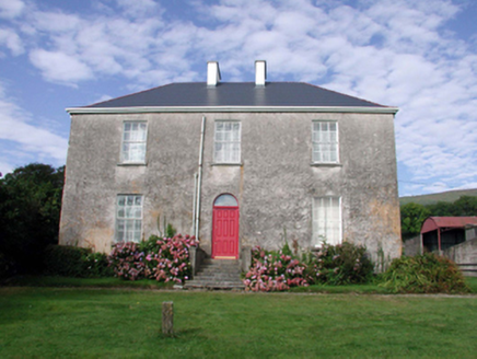 Mount KennedyHouse · 1549 yd
 farm house1725 ydDeelish MountainMountain / peak · 1.1 mi
 Horse-chestnut2.8 mi
 Dungarvan CastleCastle · 4.8 mi
 Dungarvan Castle (in Ruins)Castle, Anglo-Norman masonry castle · 4.8 mi
 Grattan SquareVisitor information · 4.9 mi
 Waterford County MuseumMuseum · 4.9 mi
 Cunnigar PointHeadland · 5.0 mi
 Master McGrathMemorial · 5.5 mi
More archaeology and monuments in County Waterford · All of County Waterford
What do you know about this place?