
What is recorded here
Situated towards the bottom of a gentle S-facing slope. An early ecclesiastical site which may have had an oval ecclesiastical enclosure (WA008-030002-) originally, but this is now truncated at S by an E-W field bank. D-shaped, grass-covered area (dims. 58m E-W; 22m N-S) defined by a scarp (H 0.2-0.5m) with slight…
Read the whole record
From the National Monuments Service (Archaeological Survey of Ireland) record WA008-030002
Places near here
Photo credits
- Maker not stated on source page, account.travel
- Maker not stated on source page, www.pinterest.com
- Maker not stated on source page, en.wikipedia.org
- Maker not stated on source page, pixels.com
- National Inventory of Architectural Heritage
- Maker not stated on source page, commons.wikimedia.org
- Maker not stated on source page, br.pinterest.com
- Peter Taylor, Wikimedia Commons · CC BY-SA 2.0
- Kmcnamee, Wikimedia Commons · CC BY-SA 4.0
 Bullaun stone in KilmoveeBullaun stone · 51 yd
Explorer Tom Bullaun stone in Kilmovee has a family tree that I mostly made up because the real one involves three different…
 Standing stone in KilmoveeStanding stone · 175 yd
Explorer Tom This standing stone in Kilmovee would ace any job interview, claiming two millennia of stability experience. It just…
 Enclosure in KilmoveeEnclosure · 290 yd
Explorer Tom Kilmovee’s enclosure has a standing stone in the middle, which might be treasure or just a really old biscuit tin. It’s…
 Fairy fort / ringfort in KilmoveeFairy fort / ringfort · 1665 yd
Explorer Tom Kilmovee’s ringfort is invisible from the ground, so it’s basically a secret shared between the soil and the sky.…
 Fairy fort / earthen ringfort in BallydurnFairy fort / earthen ringfort · 1.1 mi
Explorer Tom This Ballydurn ringfort has a moat that’s basically a puddle and a wall that’s half gone. The original owner escaped…
 farmyard complex1.4 mi
Explorer Tom Farmyard complex in Hacketstown is where the whole parish argued about whose pig was actually the mayor. The buildings…
 Saint John's Church (Guilcagh)Church/chapel · 1.5 mi
Explorer Tom Saint John's Church in Guilcagh looks like it was designed by someone who really wanted to look medieval but ran out of…
 Newtown/Ballydurn GAA pitchGAA ground · 1.6 mi
 Standing stone in FallaghStanding stone · 1.6 mi
Explorer Tom Standing stone in Fallagh has an imaginary fan club of sheep who think it’s their personal therapist on the gentle…
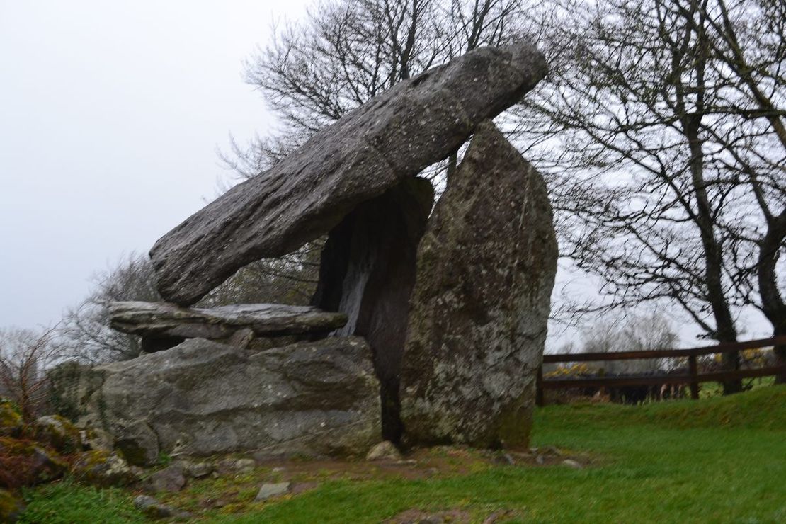
 DolmenPortal tomb · 1.8 mi
Explorer Tom Whitestown East Dolmen is just a giant stone lid sitting on a collapsed room, looking thoroughly annoyed at the council…
 Croughaun HillMountain / peak · 3.5 mi
Explorer Tom Croughaun Hill has been hiding a massive scandal involving a lost hat and a very confused shepherd for centuries. The…
 John Mitchels GAA pitchGAA ground · 4.0 mi
More archaeology and monuments in County Waterford · All of County Waterford

What do you know about this place?Tap to add a comment or ask a question