
What is recorded here
On a gentle S-facing slope, on a low rise, in pasture, with good views from NW-N-NE and from SE-S-SW, abutting a land drain to E which marks townland boundary with Moanroe. Enclosures (LI024-013/014----) lie 105m to SE and 130m to E, respectively. Depicted on the 1897 ed. OSi 25-inch map as a penannular-shaped…
Read the whole record
From the National Monuments Service (Archaeological Survey of Ireland) record LI025-012
Places near here
Photo credits
- Maker not stated on source page, ru.pinterest.com
- Maker not stated on source page, www.wikidata.org
- Maker not stated on source page, commons.wikimedia.org
- National Inventory of Architectural Heritage
- Sheila1988, Wikimedia Commons
- Maker not stated on source page, www.thejournal.ie
- Mike Searle, Wikimedia Commons · CC BY-SA 2.0
 Earthwork in Moanroe (coonagh By.)Earthwork · 696 yd
Explorer Tom Earthwork in Moanroe in County Limerick is playing hard to get, hiding under thick grass like it’s shy. The locals call…
 Fairy fort / earthen ringfort in Garryduff (coonagh By.)Fairy fort / earthen ringfort · 1254 yd
Explorer Tom Fairy fort / earthen ringfort in Garryduff nearly went viral for looking like a giant doughnut. It’s just a soggy…
 Earthwork in Keeloges (coonagh By.)Earthwork · 1731 yd
Explorer Tom Earthwork in Keeloges has a strong opinion from the local sheep who think it’s the best spot for a nap in the county.…
 Oola National SchoolSchool · 1.1 mi
Explorer Tom Oola National School in Moanoola would write 'seeking someone with good grades and no homework' on its dating profile.…
 Castle LloydFolly · 1.1 mi
Explorer Tom Castle Lloyd is just a fancy rock pile pretending to be a castle, but it’s suspicious of every postman. It thinks…
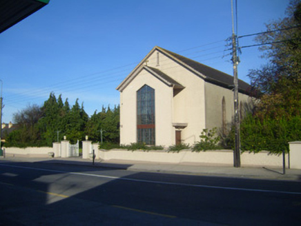 Catholic Church of the Sacred HeartChurch/chapel · 1.1 mi
Explorer Tom This church in Moanoola would write 'no bells allowed' on its dating profile because of old laws. The stained glass is…
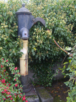 water pump1.1 mi
Explorer Tom Water pump in Moanoola is locked in a feud with the next village over something daft, probably who has the better water…
 Church in Glebe (coonagh By.)Church · 1.2 mi
Explorer Tom Church in Glebe is guarding a hidden treasure that is definitely a biscuit tin left behind by a very confused Victorian…
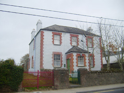 Oola Garda Síochána StationHouse · 1.2 mi
Explorer Tom Oola Garda Station has been having a serious drama with the nearest tree for decades. Its tall chimneys are basically…
 Oola GAA FieldGAA ground · 1.3 mi
Explorer Tom Oola's red gate gives the game away before a ball has even been thrown in: this is a parish serious about its football.…
 Oola Castle RuinsViewpoint · 1.6 mi
Explorer Tom Oola Castle Ruins in County Limerick is basically a haunted viewpoint that screams about its missing walls. I bet it…
 Oola Castle (in ruins)Castle, tower house · 1.6 mi
Explorer Tom Oola Castle is hiding a scandal on Oola Hill that has been whispered about for centuries without ever being proven. It…
More archaeology and monuments in County Limerick · All of County Limerick

What do you know about this place?Tap to add a comment or ask a question