What is recorded here
Internal diam. 28m. A circular enclosure delimited by a stone-built wall complete on all but the N side, where a field boundary cuts across it. Beyond this wall, the arc of the bank continues to be barely visible. To the W is a possible outer wall, which turns S to meet a field wall. To the N of this is a possible…
Read the whole record
From the National Monuments Service (Archaeological Survey of Ireland) record DG012-033001
Places near here
Photo credits
- National Inventory of Architectural Heritage
- Kenneth Allen, Geograph · CC BY-SA 2.0
- Maker not stated on source page, www.amazon.com
- Maker not stated on source page, www.tripadvisor.co.uk
- Maker not stated on source page, br.pinterest.com
- Maker not stated on source page, en.wikipedia.org
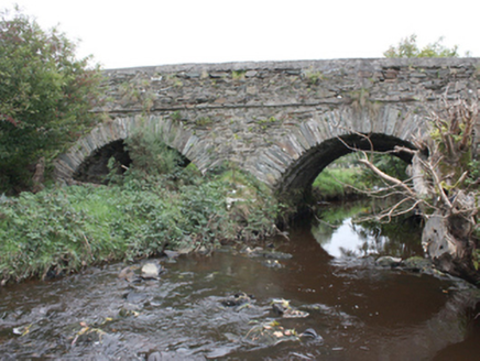 Milltown BridgeBridge · 1620 yd
Explorer Tom Milltown Bridge has crossed the Gleneely since c. 1800, showing off fine masonry that outlasted the nearby corn mill…
 Orchard BarPub · 1654 yd
Explorer Tom Orchard Bar in County Donegal has an unlikely celebrity friend who only visits when the cider is fresh. I’d bet they…
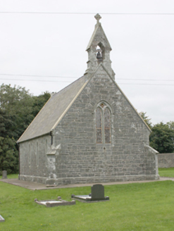 All Saints Church of Ireland ChurchChurch/chapel · 1657 yd
Explorer Tom All Saints Church of Ireland Church has been standing in Aghaglassan since 1856, its green rubble stone walls looking…
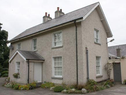 Gleneely Church of Ireland RectoryRectory/glebe/vicarage/curate's house · 1665 yd
Explorer Tom Gleneely Church of Ireland Rectory is a c. 1860 gem with those tooled limestone gate piers matching All Saints’ Church…
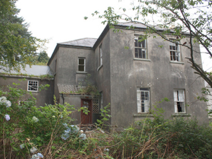 Falmore HouseCountry house · 1759 yd
Explorer Tom Falmore House is an 1850 puzzle with a limestone plaque proudly naming its builder, J Steele-Nicholson. It’s got that…
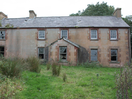 Leitrim HouseFarm house · 1.1 mi
Explorer Tom Leitrim House was built around 1850 with five bays and two different sash-window patterns. Its outbuildings immediately…
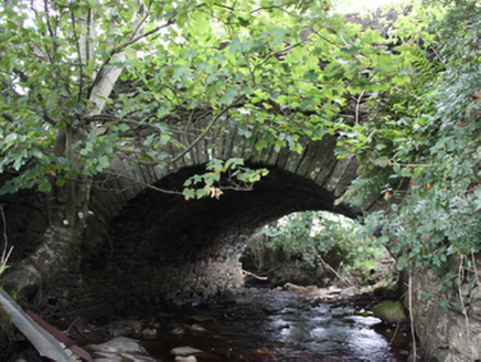 Ballintroohan BridgeBridge · 1.2 mi
Explorer Tom Ballintroohan Bridge has been taking the traffic since c. 1800, proving that simple masonry skills can stand the test…
 Killycooley Burial GroundBurial ground · 1.2 mi
Explorer Tom The road gave up bones at Killycooley Burial Ground, then the ground went quiet again. The survey recorded no visible…
 bridge1.3 mi
Explorer Tom Aghaglassan's bridge carries one narrow road over three square openings roofed by enormous flat stone lintels. It is…
 Former Aghaglassan Burial GroundBurial ground · 1.6 mi
Explorer Tom Former Aghaglassan Burial Ground is a fifty-foot circle that locals seem to have completely forgotten. No one here…
 Mapped graveyardGraveyard · 1.9 mi
Explorer Tom This graveyard is waiting for its moment in the sun, or rather, the moon, since it’s all about the afterlife here. It…
 Clonca Old Church GraveyardGraveyard · 2.5 mi
Explorer Tom Clonca Old Church Graveyard has an early site inside a later frame: a sub-rectangular burial ground encloses the church…
More archaeology and monuments in County Donegal · All of County Donegal

What do you know about this place?Tap to add a comment or ask a question