
Places near here
Photo credits
- National Inventory of Architectural Heritage
- Douglas P. Bermingham, Wikimedia Commons · CC0
- Douglas P.Bermingham, Wikimedia Commons · CC BY-SA 3.0
- Kenneth Gallery Smyth, Geograph · Creative Commons Attribution-ShareAlike 2.0
- Stephan van Helden, Wikimedia Commons · CC BY-SA 4.0
- Malene Thyssen, Wikimedia Commons · CC BY-SA 3.0
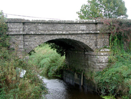 Kinnafad BridgeBridge · 545 yd
Explorer Tom Kinnafad Bridge over the Boyne smells like wet limestone and ancient drainage schemes, according to Tom’s expert nose. It replaced an older bridge that probably smelled worse. Ideal for a moody photo op on the riverbank.
 Kinnafad Castle (ruins)Castle · 703 yd
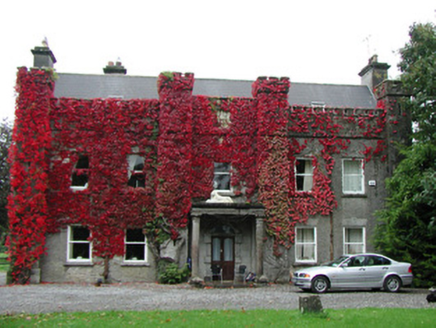 Jonestown HouseCountry house · 853 yd
Explorer Tom Jonestown House in Offaly looks down its nose at Dubliners like they just arrived from the moon. The castellated parapet is pure drama, and those carved plaques are hiding secrets I refuse to tell you. Look up, the best gossip is happening right above your head.
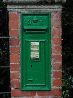 post box948 yd
Explorer Tom Post box in Jonestown started a feud between two families over who gets to stand closest for photos. It’s still working hard with that royal cipher from George V’s reign, looking very important. If it’s there, it’s definitely judging your posture while you post.
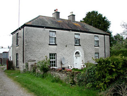 Kinnafad HouseHouse · 1252 yd
Explorer Tom Kinnafad House is stuck in a fairy dispute over parking rights for tiny wings. It’s an 18th-century gentleman’s home that’s had some serious modern additions bolted onto it. Stop the car, it's worth a quick glance from the kerb.
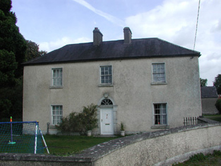 Roosk HouseHouse · 1328 yd
Explorer Tom Roosk House just refuses to fall down because it’s too proud of that fancy limestone door. It looks down on every other farmhouse in the county, honestly. Practise your Irish on it, it won’t mind the accent.
Burial mound in Mountwilson,thornwellBurial mound · 1755 ydExplorer Tom Burial mound in Mountwilson had half its body removed in the 1880s, so it’s basically a one-armed giant. Forty skeletons left, which is rude, but hey, at least it’s got views. Perfect detour when the satnav has a meltdown.
 Grange CastleCastle, tower house · 1.2 mi
Explorer Tom Grange Castle would explain the 1800s to a teenager by saying, 'It was basically just waiting for the state to take over.' It’s a tower house that has been through more families than a soap opera. Have a wander and a wonder.
Moat HillMountain / peak · 5.0 mi Downan Grave YardGraveyard · 6.7 mi
 Horse-chestnut7.0 mi
 European Beech11 mi
Explorer Tom European Beech in County Meath is sick of people asking if it talks to the other trees; yes, they gossip, shut up. It’s got that tired look of someone who’s heard every question before. Bring a flask of something warm and a story to swap.
More mountains and hills in County Offaly · All of County Offaly

What do you know about this place?Tap to add a comment or ask a question