Places near here
Photo credits
- Kmcnamee, Wikimedia Commons · CC BY-SA 4.0
- National Inventory of Architectural Heritage
- C O'Flanagan, Geograph · CC BY-SA 2.0
- Thomas Nugent, Geograph · CC BY-SA 2.0
- C O'Flanagan, Geograph · Creative Commons Attribution-ShareAlike 2.0
- Willow, Wikimedia Commons · CC BY 2.5
- J. Stirling Coyne, Wikimedia Commons · Public domain
- Patrick Brown, Wikimedia Commons · CC BY-SA 2.0
- Neil Forrester, Co.Meath, Ireland. http://neil.forrester.ie, Wikimedia Commons · CC BY 3.0
- August Schwerdfeger, Wikimedia Commons · CC BY 4.0
 Kiltale GAAGAA ground · 1466 yd
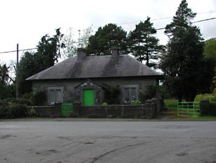 worker's house1.6 mi
Explorer Tom Worker's house in Dunsany refuses to fall down because it’s too stubborn, holding onto its slate roof and sash windows…
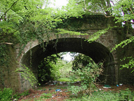 bridge1.6 mi
Explorer Tom Bridge in Dunsany is showing off its masonry skills because it knows trains used to cross here with flair. It’s part of…
 Dunsany CrossCross, Wayside cross · 2.3 mi
Explorer Tom Dunsany Cross is like the awkward uncle at a wedding, standing right by the castle entrance and pretending it doesn’t…
Dunsany GAA pitchGAA ground · 2.7 mi Killeen CastleCastle, tower house · 2.9 mi
Explorer Tom Killeen Castle has a curse that only affects people who don't wave when they pass by, so make sure you give it a big…
 IndicatedGraveyard · 3.2 mi
Explorer Tom Graveyard in Kilmessan would tell the new church to stop hogging the spotlight and share the headstones. The medieval…
 European ash3.9 mi
Explorer Tom European ash in County Meath is the rabbits’ favourite playground, and they think it owes them rent for living there.…
 Dangan CastleCastle, tower house · 4.1 mi
Explorer Tom Dangan Castle thinks Dublin tourists are all wind and no substance because they never stay long enough to appreciate…
 Battle of Tara (Ireland)Major battlefield · 4.8 mi
Explorer Tom Battle of Tara (Ireland) in County Meath has had more names than I have socks in my drawer right now. Kings fought…
 Battle of Tara HillBattle · 4.8 mi
Explorer Tom Battle of Tara Hill is still trying to remember if it was a fight or just a very aggressive family gathering. A fiddler…
 Lia Fáil: Hill of TaraLegend location · 4.9 mi
Explorer Tom Lia Fáil: Hill of Tara is a stone with high standards. Legend says it shouted for the rightful king, which would make…
More archaeology and monuments in County Meath · All of County Meath

What do you know about this place?Tap to add a comment or ask a question