
What is recorded here
Situated on the NE side of the Dunshaughlin to Kilmessan road opposite the entrance avenue to Dunsany castle (ME037-018----) and c. 200m N of Dunsany church (ME037-019----). The cross (H 2.35m) was thought to be a fossiliferous limestone but is probably granite. It is rectangular in cross-section and consists of a shaft (dims 0.25m x 0.17m; H 1.22m), collar (dims 0.31m x 0.16m; H 0.29m) and upper shaft (dims 0.21m x 0.13m; H 0.84m) set in a rectangular base (dims 0.92m x 0.88m; H 0.14m) that also has two basins of a bullaun stone (ME037-044----). The base is on a plinth of three steps. The edges of the shaft are chamfered and the narrow sides taper. The upper shaft is a Latin cross decorated on the W side in false relief with a crucifixion at the crux and a winged ox, a symbol of St Luke, in the panel above. There is a small mortice on the top of the upper shaft. A date of c. 1600 is suggested (King 1984, 108). This cross was badly vandalised on 1 June 2013 when the shaft was broken just above the base and the head was fractured into three large pieces. The cross was conserved by Laurent Madelmont for the Dunsany estate and re-erected in August 2014 (Meath Chronicle c. 14/08/2014). (Westropp 1894, 227-9; Moore 1987, no. 1535)
Compiled by: Geraldine Stout, Michael Moore
Date of revised upload: 05 September, 2014
Situated on the NE side of the Dunshaughlin to Kilmessan road opposite the entrance avenue to Dunsany castle (ME037-018----) and c. 200m N of Dunsany church (ME037-019----). The cross (H 2.35m) was thought to be a fossiliferous limestone but is probably granite. It is rectangular in cross-section and consists of a shaft (dims 0.25m x 0.17m; H 1.22m), collar (dims 0.31m x 0.16m; H 0.29m) and upper shaft (dims…
From the National Monuments Service (Archaeological Survey of Ireland) record ME037-017
The monument record does not grant public access. Check the route and ask the landowner before entering private land.
- What survives
- Recorded monument
Places near here
Photo credits
- National Inventory of Architectural Heritage
- Skarldrums, Wikimedia Commons · CC BY-SA 4.0
- Tim Wilson, Geograph · CC BY-SA 2.0
- C O'Flanagan, Wikimedia Commons · CC BY-SA 2.0
- C O'Flanagan, Geograph · Creative Commons Attribution-ShareAlike 2.0
- William Murphy, Wikimedia Commons · CC BY 2.0
- Neil Forrester, Co.Meath, Ireland. http://neil.forrester.ie, Wikimedia Commons · CC BY 3.0
- Anthony Foster, Geograph · CC BY-SA 2.0
- Patrick Brown, Wikimedia Commons · CC BY-SA 2.0
- Malene Thyssen, Wikimedia Commons · CC BY-SA 3.0
- Roger Culos, Wikimedia Commons · CC BY-SA 3.0
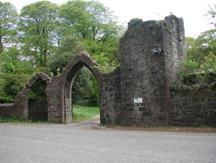 Dunsany CastleGate lodge · 17 yd
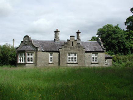 Dunsany CastleSteward's house · 73 yd
 Dunsany CastleCastle · 428 yd
 Dunsany CastleCastle, unclassified · 443 yd
 Rath MeaveHenge · 2.0 mi
 IndicatedGraveyard · 2.2 mi
 Battle of Tara (Ireland)Major battlefield · 2.7 mi
 Battle of Tara HillBattle · 2.7 mi
 Saint Patrick'sMemorial · 3.0 mi
 Hill of TaraVisitor information · 3.0 mi
 European Beech4.5 mi
 Small-leaved Elm5.2 mi
More archaeology and monuments in County Meath · All of County Meath
What do you know about this place?