What is recorded here
From OpenStreetMap (© OpenStreetMap contributors) n6567837348
Places near here
Photo credits
- Maker not stated on source page, en.wikipedia.org
- Maker not stated on source page, commons.wikimedia.org
- Maker not stated on source page, en.topwar.ru
- Maker not stated on source page, tr.pinterest.com
- National Inventory of Architectural Heritage
- Dr Charles Nelson, Geograph · CC BY-SA 2.0
- Hywel Williams, Geograph · CC BY-SA 2.0
- Mat Tuck, Geograph · CC BY-SA 2.0
- colm, Geograph · CC BY-SA 2.0
 Stone CircleStone circle, multiple-stone · 894 yd
Explorer Tom Stone Circle in Shronebirrane is a circle of eight stones that started a feud over who gets the best view. The broken…
 Fairy fort / earthen ringfort in Deelis (glanarought By., Glanmore Ed)Fairy fort / earthen ringfort · 1182 yd
Explorer Tom Fairy fort / earthen ringfort in Deelis has a family tree full of cousins nobody wants to meet. It’s heavily overgrown…
 Enclosure in Deelis (glanarought By., Glanmore Ed)Enclosure · 1525 yd
Explorer Tom Enclosure in Deelis has a name that sounds like it was invented by a drunk goat. It’s a tiny circle of dirt pretending…
 Standing stone in GortavalligStanding stone · 1645 yd
Explorer Tom Standing stone in Gortavallig was designed by a strict mother-in-law who hated slouching. It narrows to a point at the…
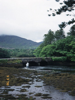 Cappul BridgeBridge · 1.6 mi
Explorer Tom Cappul Bridge posts photos of the tidal river on its social media feed to prove it's living a double life. It spans the…
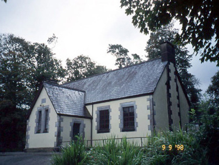 Lauragh National SchoolSchool · 1.7 mi
Explorer Tom Lauragh National School thinks tourists from Dublin are just children with better shoes and worse manners. It’s been…
 Derreen HouseHouse · 1.9 mi
Explorer Tom Derreen House in Kerry had a first owner with an escape plan involving rhododendrons and tree ferns. Built around 1865…
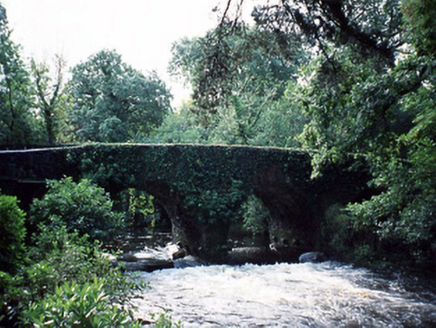 Lauragh BridgeBridge · 2.0 mi
Explorer Tom Lauragh Bridge was built by a giant who simply got bored of carrying rocks himself. He left a note saying he’d be back…
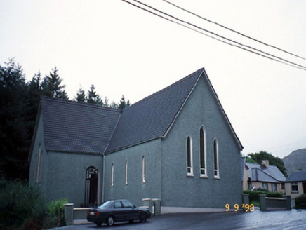 Saint Killian's Catholic ChurchChurch/chapel · 2.2 mi
Explorer Tom Saint Killian's Catholic Church in Derreen would complain to the council about the lack of parking for angels. It’s got…
 Dursey Cable CarHeritage attraction · 18 mi
Explorer Tom Dursey Cable Car in County Cork operates on a local superstition that if you close your eyes, you’ll arrive at the…
 Dursey IslandVisitor information · 18 mi
Explorer Tom Dursey Island has this weird curse where if you don't wave at the cable car, your Wi-Fi stops working for a week. It’s…
 The CalfIslet · 22 mi
Explorer Tom The Calf in County Cork was once visited by a poet who fell into the ditch and wrote a sonnet about his muddy knees. It…
More mountains and hills in County Kerry · All of County Kerry

What do you know about this place?Tap to add a comment or ask a question