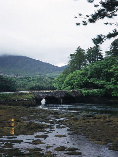
What is recorded here
Cappul Bridge at Reenkilla gives the tidal Croanshaugh two arches to come and go through. Most rivers pass under a bridge and have the manners to leave; this one comes back like a relation who has remembered a second grievance.
Double-arch rubble stone road bridge over river, built c. 1835, with V-cutwaters. Spans Croanshaugh river which is tidal at this point.
From the Buildings of Ireland (National Inventory of Architectural Heritage) record 21310807
This does not grant access. Most recorded buildings are privately owned; view them only from public ground unless the owner allows entry.
Places near here
Photo credits
- National Inventory of Architectural Heritage
- Mike Dickison, Wikimedia Commons · CC BY 4.0
- Dr Charles Nelson, Geograph · CC BY-SA 2.0
- Yosemite, Wikimedia Commons · CC BY-SA 3.0
- Trevor Harris, Geograph · CC BY-SA 2.0
- Richard Webb, Wikimedia Commons · CC BY-SA 2.0
- Michael Dibb, Geograph · Creative Commons Attribution-ShareAlike 2.0
- David Purchase, Geograph · CC BY-SA 2.0
- Gordon Hatton, Geograph · CC BY-SA 2.0
- Jeff Buck, Geograph · CC BY-SA 2.0
- Espresso Addict, Wikimedia Commons · CC BY-SA 2.0
- Marathon, Geograph · CC BY-SA 2.0
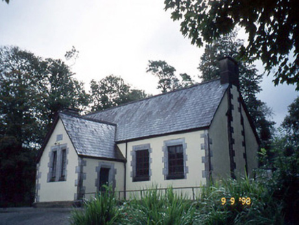 Lauragh National SchoolSchool · 291 yd
 New Zealand broadleaf721 yd
 Derreen HouseHouse · 737 yd
 Japanese cedar749 yd
 KnockateeMountain / peak · 1.4 mi
 KnockastumpaMountain / peak · 1.5 mi
 Burial GroundGraveyard · 1.9 mi
 Rossmore IslandIsland · 4.4 mi
 Ormond's IslandIslet · 4.5 mi
 Mare's Tail WaterfallViewpoint · 5.0 mi
 Uragh Stone CircleArchaeological place · 5.0 mi
 De Gaulle MemorialMonument · 7.4 mi
More historic places in County Kerry · All of County Kerry
What do you know about this place?