What is recorded here
House, marked 'Cronodymore (in ruins)' on 1842 OS 6-inch map, built c. 1716, using stone removed from nearby Inishleena Abbey (CO072-044002-); described as 'of a rectangular plan, 60 feet long in the front, facing south, and 25 feet deep, three storeys high, and with a chimney, standing up at each of the four corners'…
Read the whole record
From the National Monuments Service (Archaeological Survey of Ireland) record CO072-041
Places near here
Photo credits
- National Inventory of Architectural Heritage
- Jonathan Thacker, Geograph · Creative Commons Attribution-ShareAlike 2.0
- Hywel Williams, Geograph · CC BY-SA 2.0
- Maker not stated on source page, it.pinterest.com
- Maker not stated on source page, commons.wikimedia.org
- Maker not stated on source page, www.irishexaminer.com
- Aghabullogue GAA / EchoLive source; photographer not named, www.echolive.ie
- Algirdas at Lithuanian Wikipedia, Wikimedia Commons · Public domain
- Maker not stated on source page, uk.pinterest.com
- Mike Searle, Wikimedia Commons · CC BY-SA 2.0
 Clashanure HouseCountry house · 1688 yd
Explorer Tom Clashanure House is all about symmetry and order, with slate roofs that look like they’re ready for a very fancy…
 Shandy HallOutbuilding · 1.3 mi
Explorer Tom Shandy Hall in Kilgobnet is currently being negotiated for by a cow who wants to buy it as a retirement home. It’s part…
 Dripsey BridgeBridge · 1.3 mi
Explorer Tom Dripsey Bridge in Agharinagh has six arches and was damaged in 1921 during the Troubles. It also hosted a supernatural…
 Dripsey BrBridge · 1.3 mi
Explorer Tom Dripsey Br was designed by a mother-in-law who wanted every arch to be slightly different. It got blown up in the 1920s…
 Fairy fort / earthen ringfort in Farran (muskerry East By.)Fairy fort / earthen ringfort · 1.6 mi
Explorer Tom This Fairy fort / earthen ringfort in Farran is levelled but Hartnett said there’s a raised platform. I say we check…
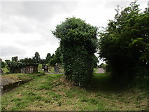 Grave YardGraveyard · 2.1 mi
Explorer Tom Graveyard in Aglish sits on a ridge, watching the Lee valley while pretending it isn’t also a church ruin. There’s a…
 Mapped cemeteryCemetery · 2.1 mi
Explorer Tom Mapped cemetery in County Cork would explain the 1800s to a teenager by saying, 'Imagine no Wi-Fi, everyone wearing…
 Inniscarra GAA pitchGAA ground · 2.7 mi
 Coachford, AghabullogueGAA ground · 2.8 mi
 Pedunculate Oak4.4 mi
Explorer Tom Another Pedunculate Oak in County Cork is hiding a scandal from centuries ago that involved a missing hat and a very…
 Castle (in Ruins)Castle, tower house · 5.0 mi
Explorer Tom Castle in Castlemore sits on a limestone outcrop next to a modern quarry dump. The south slope is all collapsed…
 Castlemore CastleCastle · 5.0 mi
Explorer Tom Castlemore Castle in County Cork is run by a dog who thinks he's the owner. He barks at anyone who doesn't have a…
More historic places in County Cork · All of County Cork

What do you know about this place?Tap to add a comment or ask a question