DDiscover AloneMapAbout

Croaghan Island Stone Ringfort

Fairy fort / stone ringfort

The monument record does not grant public access. Check the route and ask the landowner before entering private land.

What do you know about this place?Tap to add a comment or ask a question

What you write will be public.

What is recorded here

On Croaghan Island, a small rocky island located in a long inlet that opens to NE off Mulroy Bay, at the NW end of the Fanad Peninsula. The island is hump-backed, with the high interior sloping outward to a cliff-edged perimeter. It is overlooked at E by the steeply rising slopes of the mainland. It is easily…

Read the whole record
On Croaghan Island, a small rocky island located in a long inlet that opens to NE off Mulroy Bay, at the NW end of the Fanad Peninsula. The island is hump-backed, with the high interior sloping outward to a cliff-edged perimeter. It is overlooked at E by the steeply rising slopes of the mainland. It is easily accessible from the mainland, separated from it by a narrow channel of shallow water, which becomes a natural gravelly causeway at low tide. A rock outcrop projecting from the island and a similar rocky projection on the mainland narrow the watery gap/causeway to a length of c. 15m. The causeway has been augmented in the modern era by the addition of low, roughly piled boulders (Wth 0.8-1m; H 0.4m) and fragments of concrete water piles. A small stony beach on the opposite, NW side of the island provides a landing for boats. The island is largely engulfed in hazel and blackthorn scrub and dense clumps of brambles and bracken. This possible cashel encompasses a relatively level terrace at the SE tip of the island, exploiting the natural terrain to good effect. To NW–N ground rises to the rocky summit dominating the N half of the island; this high point provides excellent views N and S along the length of the inlet. Subcircular or oval area (c. 65-70m N–S; c. 60m E–W) defined on the W half in a broad curving arc SSE–NE by a stone bank/wall. The wall is concealed by bracken and brambles and is difficult to examine; it is mostly evident as a low, vegetation-covered rise. Where sections all can be glimpsed, it appears to consist of a slumped bank (Wth 1.5-2m) of large stones with no obvious evidence of built masonry. At N it disappears into an impenetrable ticket of hazel, blackthorn and brambles so that the NE arc cannot be follow. A gap (Wth c. 2m) in the enclosing wall at W is possibly an original entrance. The wall appears to terminate at NE and SE at the cliff/scarp that edges the island. The E arc of the enclosure, therefore, coincides with the break of slope at the top of the cliff, and it is unclear if the enclosing wall ever continued here along the top of the cliff. The top of the cliff forms a broadly sloping vegetation-covered scarp, which then becomes a vertical rock-face, dropping to the water’s edge. The interior of the enclosure is strewn with stones, and largely obscured by bracken and clumps of brambles. It slopes down gently from the enclosing wall at W towards the centre where it levels out. A gapped linear stony feature, concealed by overgrowth, on a roughly N–S axis coincides with the change of slope, possibly a subdivision of the interior. Rock-outcropping protrudes in the NE quadrant of the interior and there is a rectangular enclosure (DG017-031002-) of uncertain function in the level SE quadrant. This possible cashel is not shown on any edition of the OS 6-inch maps. It is difficult to examine at ground level, and difficult to interpret and date. It may be a cashel, or it may be an enclosure of later date. Notified to National Monuments Service by Martin Cauley. Attached images: DG017-031001-_01.JPG Possible cashel viewed from NW DG017-031001-_01.JPG W arc of enclosing wall viewed from N Compiled by: Jane O’Shaughnessy Date of upload: 20 June 2023

From the National Monuments Service (Archaeological Survey of Ireland) record DG017-031001

Places near here

Photo credits
  • Maker not stated on source page, ru.pinterest.com
  • Maker not stated on source page, www.ireland.com
  • Maker not stated on source page, www.walkhighlands.co.uk
  • Willie Duffin, Geograph · CC BY-SA 2.0
  • National Inventory of Architectural Heritage
  • Maker not stated on source page, milltown.galwaycommunityheritage.org
  • Maker not stated on source page, en.wikipedia.org
  • Kenneth Allen, Geograph · CC BY-SA 2.0
  • Maker not stated on source page, ru.dreamstime.com
Greers IsleIslet · 684 yd

Explorer Tom Greers Isle in County Donegal once had a cow try to buy it with a single hoof-print, which was a bold move but probably…

Lambs IsleIslet · 794 yd

Explorer Tom Lambs Isle would describe itself to a stranger as 'a bit of a rough diamond with excellent views and no electricity.'…

Croaghan CairnCairn, unclassified · 1024 yd

Explorer Tom Croaghan Cairn is a shy little pile tucked into a narrow valley, but it rewards you with a stunning view over Mulroy…

St. Columba’s Roman Catholic ChurchChurch/chapel · 1082 yd

Explorer Tom St. Columba’s Roman Catholic Church in Croaghan would cope on a reality show by refusing to leave the room until…

walled garden1272 yd

Explorer Tom Walled garden in Carrowkeel Glebe has a tiny wrought-iron flat bar gate that looks too serious for just tomatoes. I…
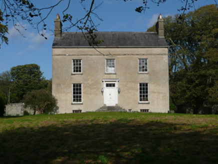
Fanad GlebeRectory/glebe/vicarage/curate's house · 1308 yd

Explorer Tom Fanad Glebe was built with just one hundred pounds, which sounds like a pocketful of coins. I bet they stacked those…

Burial ground in LurgacloghanBurial ground · 1698 yd

Explorer Tom Burial ground in Lurgacloghan is known locally as Cille Brie, supposedly holding St. Bricne himself. The oval stone…
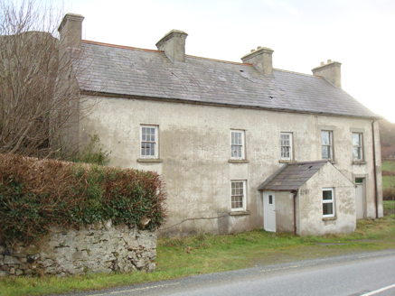
Kindrum Post OfficeHouse · 1726 yd

Explorer Tom Kindrum Post Office, built c.1860, has just a ghostly outline where the post box used to hang. I bet that little square…

Standing stone in BallyhorkStanding stone · 1.0 mi

Explorer Tom Standing stone in Ballyhork used to be called a 'Giant's Grave', which is peak myth-making. It stood proud in 1835, but…
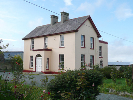
St. Columba's Parochial HousePresbytery/parochial/curate's house · 1.1 mi

Explorer Tom St. Columba's Parochial House has a round-headed doorway that looks like it’s winking at you from the front porch.…

Moross CastleCastle, tower house · 1.2 mi

Explorer Tom Moross Castle was built in 1532 and sits on a tiny rocky island connected by a causeway. By 1622, someone had slapped a…

Mapped graveyardGraveyard · 1.8 mi

Explorer Tom Another Mapped graveyard in County Donegal for us! If this place won the lotto, I bet it would buy a very fancy new…

More archaeology and monuments in County Donegal · All of County Donegal

Add to this placeAdd a picture Add a detailed tip Add a story

Explore the map1,095,414 places to discover

Next place · or swipeGreers Isle