Places near here
Photo credits
- Willie Duffin, Geograph · CC BY-SA 2.0
- National Inventory of Architectural Heritage
- Kenneth Allen, Geograph · CC BY-SA 2.0
- Shane Killen, Geograph · CC BY-SA 2.0
- Kenneth Allen, Wikimedia Commons · CC BY-SA 2.0
- Andreas F. Borchert, Wikimedia Commons · CC BY-SA 4.0
- MPF, Wikimedia Commons · CC BY-SA 3.0
- Patrice78500, Wikimedia Commons · CC BY-SA 3.0
- Kieran Evans, Wikimedia Commons · CC BY-SA 4.0
- Richard Webb, Geograph · CC BY-SA 2.0
- John M, Geograph · CC BY-SA 2.0
 St. Columba’s Roman Catholic ChurchChurch/chapel · 1475 yd
Explorer Tom St. Columba’s Roman Catholic Church in Croaghan would cope on a reality show by refusing to leave the room until everyone apologized. It’s one of the earliest surviving pre-Emancipation churches, which makes it older than most people’s great-grandparents. The size is unusual for its date, so just accept it. Stay humble around this place.
 walled garden1.1 mi
Explorer Tom Walled garden in Carrowkeel Glebe has a tiny wrought-iron flat bar gate that looks too serious for just tomatoes. I wonder if the priest had to knock three times before the door would even creak? It feels like a very strict bouncer for some radishes.
 Moross CastleCastle, tower house · 1.1 mi
Explorer Tom Moross Castle was built in 1532 and sits on a tiny rocky island connected by a causeway. By 1622, someone had slapped a thatched roof on the ruins while it lay waste, which is peak medieval DIY. Only the southwest corner survives now, but that narrow causeway makes it feel like you’re walking onto a very defensive boat.
 Trá na Rosann HostelHostel · 3.7 mi
Explorer Tom Trá na Rosann Hostel sits on the Rosguill Peninsula, claiming to be Ireland's most northerly bed. It’s basically a hunting lodge pretending to be fancy while you stare into the void. Take a mate and argue about what it was for.
 Drumfad Lower Standing StoneStanding stone · 3.7 mi
Explorer Tom This standing stone in Drumfad Lower used to stand proudly on a ridge with sweeping views of Trusk More, though it did take a tumble during a storm back in 1998. After a rescue excavation to uncover its original socket pit, it was carefully re-erected so it could keep watch over the plateau.
 Mevagh High CrossCross, High cross · 3.8 mi
Explorer Tom Mevagh High Cross is a stark, undecorated slab standing in the graveyard of a ruined medieval church. It’s simple and unadorned, which makes it feel like a quiet guardian overlooking the steep drop to Mulroy Bay. No fancy patterns here, just raw stone and history.
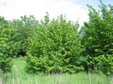 Hazel3.8 mi
Explorer Tom Hazel in County Donegal has a long list of former names because every farmer who passed by thought they could do a better job naming it. It’s got that identity crisis energy where it just shrugs and lets them call it whatever they want. Bring a camera and your most suspicious face.
 Carrigart HotelHotel · 3.9 mi
Explorer Tom Carrigart Hotel on Main Street is where ghosts go to relax after haunting castles all day long. Ask for room four; if it’s cold, just say you prefer the arctic breeze there. Best visited with a curious kid and no timetable.
 Cnoc na SleáMountain / peak · 3.9 mi
Explorer Tom Cnoc na Sleá means 'hill of the spear', though I would leave any spear firmly in the name. The guide also calls this small Donegal hill Crocknasleigh and points out its older Irish spelling. One hill, two ways to say it, and a very pointed name.
 The Murder HoleCave · 4.0 mi
Explorer Tom The Murder Hole would cope perfectly on a reality show by hiding in the corner and pretending the camera crew wasn’t there. It thinks its dark reputation is just great marketing and refuses to do any actual work or make eye contact with anyone. Spot the oldest stone and give it a silly name, because that’s what you should do.
 Boyeeghter StrandBeach / strand · 4.1 mi
Explorer Tom Boyeeghter Strand can turn from two beaches into one while you are deciding where to put your shoes. The tide joins the sands below Rosguill's cliffs; Rough Island sits only about fifteen metres out, close enough to tempt a foolish shortcut. I am good at foolish shortcuts, so take my advice on this one: leave the tidal island and the water alone. The beach is not safe for swimming. Its harsher nickname has several uncertain stories attached, and I will not turn anyone's possible loss into a joke. For years access depended on crossing private land, but a new path and car park at Melmore appeared by 2022. Check the current route and tide before going, and keep to permitted paths through the dunes. Donegal has enough drama in the cliffs and shifting sand without my inventing a reason for you to take a risk.
 Rosses StrandBeach / strand · 4.1 mi
Explorer Tom Rosses Strand is a beach where the waves at low tide are barely a foot high, which is basically the ocean taking a nap and pretending to be working hard. It would tell its younger self to stop trying so hard and just enjoy being a gentle lapping sound all day long. Toast it with a cup of tea and move on to the next.
More islands in County Donegal · All of County Donegal

What do you know about this place?Tap to add a comment or ask a question