
Places near here
Photo credits
- National Inventory of Architectural Heritage
- Mike Searle, Geograph · CC BY-SA 2.0
- Maker not stated on source page, www.flickr.com
- Maker not stated on source page, commons.wikimedia.org
- Maker not stated on source page, tr.pinterest.com
- Maker not stated on source page, www.pinterest.com
- Stephen McKay, Geograph · CC BY-SA 2.0
- Kenneth Allen, Wikimedia Commons · CC BY-SA 2.0
- Maker not stated on source page, en.wikipedia.org
- Golfing in Ireland; photographer not stated, Source publisher
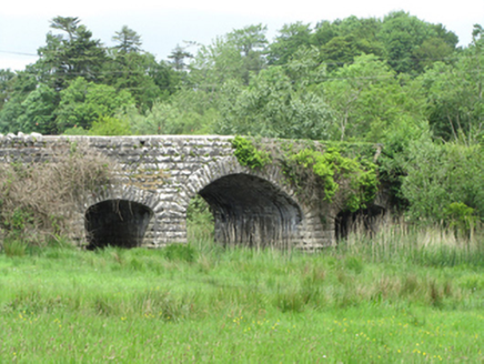 Quivvy BridgeBridge · 146 yd
Explorer Tom Quivvy Bridge is narrow and expressive, spanning between two loughs like it’s trying to keep them from falling in love.…
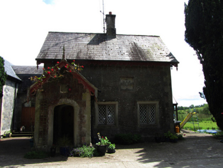 Lanesborough LodgeGate lodge · 186 yd
Explorer Tom Lanesborough Lodge would tell you after a few pints that the Earl of Lanesborough used to wear a wig made entirely of…
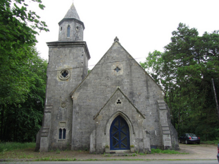 Quivvy Church (Drumlane)Church/chapel · 368 yd
Explorer Tom Quivvy Church (Drumlane) is strutting around in its Gothic Revival outfit, complete with a belfry tower that has some…
 Castle SaundersonCastle, unclassified · 1.3 mi
Explorer Tom Castle Saunderson has very strong opinions on modern buildings, mostly that they lack 'historic dampness'. The original…
 C6th Monastery; Multiperiod Church Site; Graveyard; Two-cross Shafts; Bases in GalloonC6th Monastery · 1.6 mi
Explorer Tom Galloon’s C6th monastery has a graveyard and two-cross shafts. It’s been around since before fashion was really a…
 Cairn kerb: druid's temple in Annaghmore GlebeCairn Kerb: Druid's Temple · 1.7 mi
Explorer Tom Cairn kerb: druid's temple in Annaghmore Glebe would explain the 1800s to a teenager as 'when everyone started wearing…
 Mapped cemeteryCemetery · 1.8 mi
Explorer Tom "Mapped cemetery has a prophecy written on its headstone saying it would one day become a famous nightclub, which…
 Church & graveyard in DrumcrinChurch & Graveyard · 1.8 mi
Explorer Tom Church & Graveyard in Drumcrin hums a low, mournful tune whenever the wind blows from the north-east. It’s been singing…
 Galloon IslandIsland · 1.9 mi
Explorer Tom Galloon Island in Fermanagh would handle a nosey neighbour by growing thorns all over its main path so they trip and…
 International Fishing CentrePark · 2.0 mi
Explorer Tom International Fishing Centre is in a massive feud with the next village over who has the best worms, which is honestly…
 Castle in InishfendraCastle · 2.2 mi
Explorer Tom Castle in Inishfendra is probably hiding from the neighbours. Rumour has it they argued over whose sheep was stealing…
 Belturbet Golf ClubGolf course · 2.5 mi
More archaeology and monuments in County Cavan · All of County Cavan

What do you know about this place?Tap to add a comment or ask a question