What is recorded here
From the National Monuments Service (Archaeological Survey of Ireland) record DU011-038
Places near here
Photo credits
- Maker not stated on source page, www.dreamstime.com
- Cg.wiki, Wikimedia Commons · CC BY-SA 4.0
- Maker not stated on source page, www.go-to-ireland.com
- Maker not stated on source page, www.pinterest.com
- Maker not stated on source page, ru.wikipedia.org
- National Inventory of Architectural Heritage
- Maker not stated on source page, www.flickr.com
- Mike Murphy ( talk · contribs ), Wikimedia Commons · CC BY-SA 3.0
- The British Library, Wikimedia Commons · No restrictions
 Graveyard in Ward LowerGraveyard · 178 yd
Explorer Tom Graveyard in Ward Lower is a raised oval enclosing medieval church foundations. A limestone window jamb fragment is…
 Church (in ruins)Church · 184 yd
Explorer Tom Church in Ward Lower went to ruin between 1630 and 1650, probably because it got bored of the whole religion thing.…
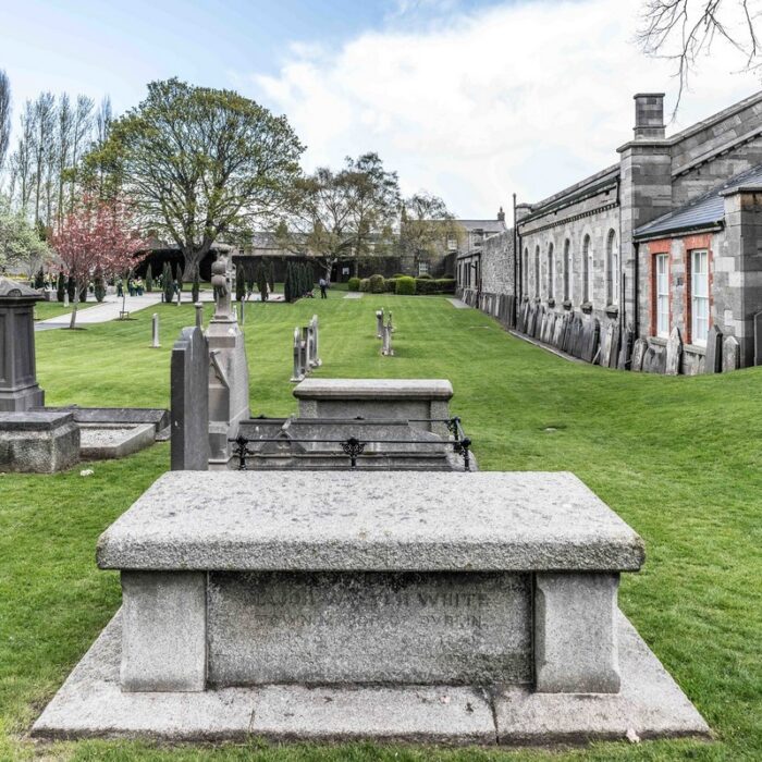 The Ward CemeteryGraveyard · 188 yd
Explorer Tom The Ward Cemetery has a reputation for being ignored by bishops who were too busy arguing about which side of the fence…
 CastleCastle, unclassified · 910 yd
Explorer Tom Castle in Spricklestown has been fighting a long grudge against the weather since the 1600s. It was held by Robert Fitz…
 Enclosure in Irishtown (dunboyne By.)Enclosure · 1.0 mi
Explorer Tom Enclosure in Irishtown has a tiny ring-ditch inside, like a secret room for its own thoughts. It's probably saying rude…
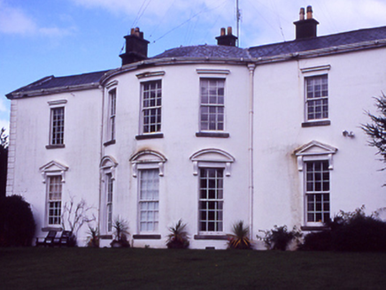 HollywoodrathCountry house · 1.1 mi
Explorer Tom Hollywoodrath is a big country house from 1830 with an Ionic portico. It’s got that grand, 'look at me' energy. Bet the…
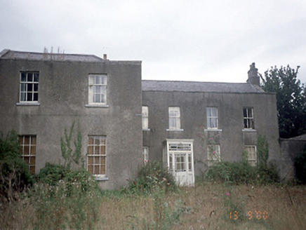 Corrstown HouseCountry house · 1.8 mi
Explorer Tom Corrstown House in Corrstown is an 1850 country house sitting in golf course grounds. It’s got an M-profile roof and…
 Graveyard in Cloghran (castleknock By.)Graveyard · 1.9 mi
Explorer Tom Graveyard in Cloghran started as a bet between two lads in the pub who dared each other to build it on a quarried edge…
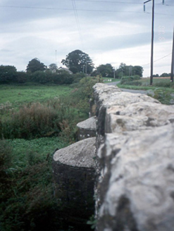 Chapelmidway BridgeBridge · 1.9 mi
Explorer Tom Chapelmidway Bridge does this weird thing where it hums a tune when nobody is looking at it properly. It’s got three…
 Church (site of)Ecclesiastical enclosure · 2.2 mi
Explorer Tom Church in Kilmartin is just a ghostly outline now, levelled out by the earthworks department back in the seventies.…
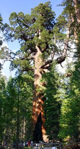 Giant Sequoia5.7 mi
Explorer Tom Giant Sequoia in County Dublin would win any county fair easily just by standing there and looking like it ate an…
 Luttrellstown CastleCastle · 5.7 mi
Explorer Tom Luttrellstown Castle in County Dublin has been featured in an 1898 book about picturesque Dublin, which makes it sound…
More archaeology and monuments in County Dublin · All of County Dublin

What do you know about this place?Tap to add a comment or ask a question