
What is recorded here
Church in Darver has doorways opposite one another at the west end: a magnificent arrangement for arriving late, spotting your mother looking straight at you, and continuing across as though you’d only come to inspect the other door.
Built of roughly coursed limestone blocks and greywacke; undivided nave and chancel (int. dims. c. 23m by c. 4.15m, Wth of walls c. 0.9m). In a poor state of preservation with part of W wall collapsed and large areas of S and N walls totally destroyed. E gable window splayed and built of undressed limestone on the outside, while inner face has been robbed of its moulded or dressed stone. Gaps in N and S walls at W ends may represent opposing doorways. It would appear from the type of stonework and the positions of the opposing doorways that this is a late medieval church. A piece of dressed sandstone with diagonal tooling, indicating a twelfth- or thirteenth-century date, was found on the rubble of the destroyed N wall, but is hardly from the present structure. (Tempest 1952b, 130)
The above description is derived from both the published 'Archaeological Inventory of County Louth' (Dublin: Stationery Office, 1986) and the 'Archaeological Survey of County Louth' (Dublin: Stationery Office, 1991).
Built of roughly coursed limestone blocks and greywacke; undivided nave and chancel (int. dims. c. 23m by c. 4.15m, Wth of walls c. 0.9m). In a poor state of preservation with part of W wall collapsed and large areas of S and N walls totally destroyed. E gable window splayed and built of undressed limestone on the outside, while inner face has been robbed of its moulded or dressed stone. Gaps in N and S walls at…
From the National Monuments Service (Archaeological Survey of Ireland) record LH011-098001
The monument record does not grant public access. Check the route and ask the landowner before entering private land.
- What survives
- Recorded monument
Places near here
 Bawn in DarverBawn · 112 yd
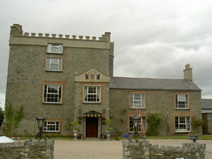 Darver CastleCastle/fortified house · 120 yd
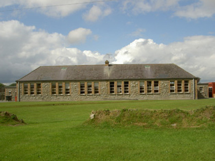 Darver National SchoolSchool · 428 yd
 IndicatedGraveyard · 1553 yd
 CastleCastle, tower house · 1.6 miLouthMountain / peak · 3.1 miDrummeenagh HillMountain / peak · 3.2 mi
 Graveyard in Richardstown (ardee By., Richardstown Par.)Graveyard · 5.0 mi
 European Beech5.1 mi
 English holly5.1 mi
 Graveyard in StickillinGraveyard · 5.2 mi
 The College (in Ruins)College · 5.6 mi
Pictures: Garry Dickinson, Geograph · CC BY-SA 2.0; National Inventory of Architectural Heritage; Kieran Campbell, Geograph · Creative Commons Attribution-ShareAlike 2.0; Garry Dickinson, Wikimedia Commons · CC BY-SA 2.0; Malene Thyssen, Wikimedia Commons · CC BY-SA 3.0; Maker named on the Wikimedia Commons picture page · Public domain; Dasmuy, Wikimedia Commons · CC BY-SA 4.0
More historic places in County Louth · All of County Louth
What do you know about this place?