
What is recorded here
A church at Kiltale and Derrypatrick is listed in the ecclesiastical taxation (1302-06) of Pope Nicholas IV (Cal. doc. Ire., 5, 255), but it probably refers to the church at Derrypatrick (ME043-010----). The Augustinian abbey of St Thomas in Dublin (DU018, 020051-) was paying for a curate at Derrypatrick and Kiltale at…
Read the whole record
From the National Monuments Service (Archaeological Survey of Ireland) record ME037-046
Places near here
Photo credits
- Kmcnamee, Wikimedia Commons · CC BY-SA 4.0
- Maker not stated on source page, en.wikipedia.org
- Maker not stated on source page, ms.fusedlearning.com
- National Inventory of Architectural Heritage
- C O'Flanagan, Geograph · CC BY-SA 2.0
- Maker not stated on source page, www.gaia.com
- Maker not stated on source page, commons.wikimedia.org
- Maker not stated on source page, stoneartblog.blogspot.com
- Maker not stated on source page, www.dreamstime.com
 Kiltale GAAGAA ground · 856 yd
 Flat cemetery in Martinstown (deece Lower By.)Flat cemetery · 1509 yd
Explorer Tom Flat cemetery in Martinstown goes quiet at dusk but locals swear it burps like a bloated cat. A guy found a pot next to…
 Fairy fort / earthen ringfort in KilcartyFairy fort / earthen ringfort · 1624 yd
Explorer Tom Fairy fort / earthen ringfort in Kilcarty had a feud with the next village over a missing fence. It only exists as a…
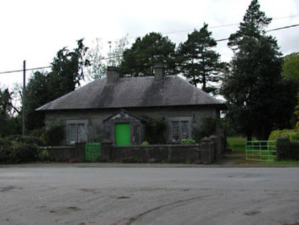 worker's house1682 yd
Explorer Tom Worker's house in Dunsany refuses to fall down because it’s too stubborn, holding onto its slate roof and sash windows…
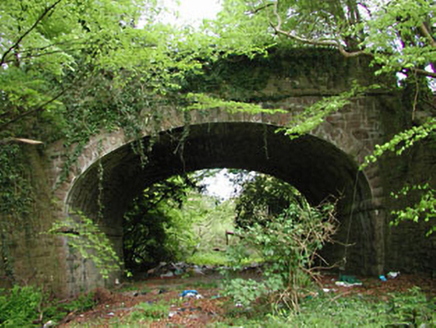 bridge1.0 mi
Explorer Tom Bridge in Dunsany is showing off its masonry skills because it knows trains used to cross here with flair. It’s part of…
 Dunsany CastleGate lodge · 1.1 mi
Explorer Tom Dunsany Castle gate lodge hums its favourite song, which is definitely 'I Am Fancy,' because of those castellations. It…
 Fairy fort / earthen ringfort in BranganstownFairy fort / earthen ringfort · 1.6 mi
Explorer Tom Fairy fort / earthen ringfort in Branganstown has a secret talent for holding its breath underwater. It’s right next to…
 Earthwork in BranganstownEarthwork · 1.7 mi
Explorer Tom Earthwork in Branganstown has an imaginary fan club that meets every Tuesday to argue about whether it’s a fort or just…
 TombTomb, effigial · 1.7 mi
Explorer Tom Tomb in Dunsany would tell a teenager that 1800s was basically medieval but with better fashion. It’s got arms for…
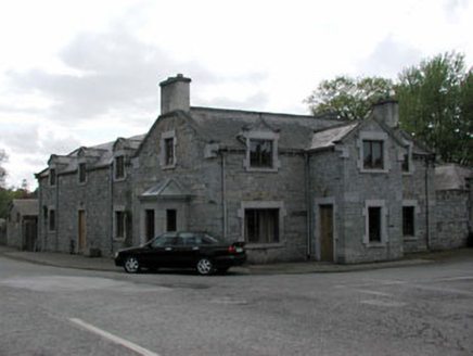 ClontaraWorker's house · 1.8 mi
Explorer Tom Clontara was built by a Baron who probably thought he was doing a favour. The windows shrink as you go up, like they’re…
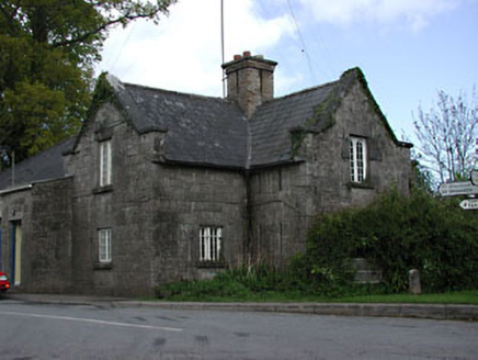 Dunsany Constabulary BarrackGarda station/constabulary barracks · 1.8 mi
Explorer Tom Dunsany Constabulary Barrack is a nineteenth-century building built by Edward Plunkett that looks like it’s still…
 Galtrom GraveyardGraveyard · 2.1 mi
Explorer Tom Galtrom Graveyard is having a bit of a Lenten fast, giving up its secrets to see if anyone actually notices the…
More historic places in County Meath · All of County Meath

What do you know about this place?Tap to add a comment or ask a question