
Places near here
Photo credits
- Andreas F. Borchert, Wikimedia Commons · CC BY-SA 4.0
- National Inventory of Architectural Heritage
- Michael Dibb, Geograph · CC BY-SA 2.0
- Paul Burns, Geograph · CC BY-SA 2.0
- Colin Park, Geograph · CC BY-SA 2.0
Explorer Tom Fairy fort or stone ringfort in Lugdoon is secretly best mates with a very famous Irish singer, though nobody can prove it. The stones are arranged like they’re waiting for a encore performance at any second. Grand place for a sulk or a snog, your call.
Enclosure in LugdoonEnclosure · 509 ydExplorer Tom Enclosure in Lugdoon is being claimed by a local who says he invented it, even though there are no remains visible at ground level to prove his genius. It’s just an arc on an old map now, sitting on a ridge overlooking a gully that looks deep enough to make you dizzy. Take a mate and argue about what it was for.
CastleCastle, tower house · 1414 ydExplorer Tom Castle in Cashelboy is a limestone tower house that gave up chocolate for Lent but kept its stubborn refusal to collapse into the pasture. It’s got two storeys and a vaulted ground floor, which sounds expensive for something sitting next to a church. Stop the car, it's worth the hazard lights.
 Catholic Church of the Immaculate ConceptionChurch/chapel · 1608 yd
Explorer Tom The Catholic Church of the Immaculate Conception in Lugdoon would write 'Looking for a partner with great stonework and no drama' on its dating profile. Its stained glass windows are so fancy they’re basically wearing jewelry to church every single day. Stand back and let those wrought-iron finials do their thing!
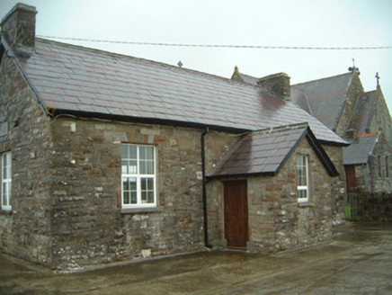 Templeterrace National SchoolSchool · 1609 yd
Explorer Tom Templeterrace National School has a long-standing grudge against the weather, blaming every crack in its local stone on one bad Tuesday in 1890. It stands next to the church looking smug about being made of such good quality material. The wind really hates this little guy's existence.
Knockalongy North-East TopMountain / peak · 3.0 miExplorer Tom Knockalongy North-East Top in County Sligo is having a massive row with a nearby tree about who has better views. The tree is winning, by the way, because it's actually growing. Mind the nettles, they're the real guards here.
KnockalongyMountain / peak · 3.0 miExplorer Tom Knockalongy in County Sligo took about forty cups of tea to build, or so the legend goes. It’s a bit lumpy, like a biscuit that got stepped on, but charmingly so. Bring your nan, she'll know more than me.
Site of Dunneill CastleCastle, unclassified · 3.2 miExplorer Tom Site of Dunneill Castle in County Sligo is perched on a bluff like it’s waiting for a royal carriage that never showed up. It’s named after Neill, which sounds like a guy who’d argue with you about the weather while pointing at nothing. The whole thing is gone, but the map still pretends otherwise, and I’m not mad about it. Pack a picnic and an excuse.
 Aughris BeachBeach / strand · 3.2 mi
Explorer Tom Aughris Beach is playing hide-and-seek with me, and I swear there's a secret tunnel straight to the pub if you know which rock to kiss. I've been staring at it for an hour and it hasn't blinked once. Bring curiosity, leave with a better story than mine.
 Aughris HeadHeadland · 3.4 mi
Explorer Tom Aughris Head in County Sligo is a headland with strong opinions, particularly about what it would order at a chipper: extra gravy, no chips, just the vibe. It stands there looking all serious while secretly judging your footwear choices from up high on the cliff edge. Get there early and have it all to yourself.
 Dunmoran StrandBeach / strand · 3.7 mi
Explorer Tom Dunmoran Strand bragged about surviving a storm that flattened houses but left this place looking merely annoyed. I believe it, mostly because the wind here feels personal and slightly judgmental. Go before the tourists find out.
 Split RockNamed rock · 5.8 mi
Explorer Tom Split Rock in County Sligo is the shortcut that isn't one, because nobody actually walks through the split. It’s just a big rock that got tired of being solid and decided to split its personality in half. Pretend it's yours and plan the housewarming party immediately.
More archaeology and monuments in County Sligo · All of County Sligo

What do you know about this place?Tap to add a comment or ask a question