What is recorded here
In pasture, situated on top of a ridge overlooking a narrow, steep-sided NW-SE gully. Not marked on the 1837 edition of the OS 6-inch map. Depicted on the 1913 edition as a hachured feature extending in an arc from WSW-N. There are no remains visible at ground level. O'Donovan
Date of upload: 19 January 2011
From the National Monuments Service (Archaeological Survey of Ireland) record SL018-034
The monument record does not grant public access. Check the route and ask the landowner before entering private land.
- What survives
- Recorded monument
Places near here
IndicatedEnclosure · 411 ydIndicatedFairy fort / stone ringfort · 494 yd Catholic Church of the Immaculate ConceptionChurch/chapel · 1242 ydTempleterrace National SchoolSchool · 1252 ydCastleCastle, tower house · 1373 ydCastleCastle, unclassified · 1.9 miAughris BeachBeach / strand · 3.0 miAughris HeadHeadland · 3.1 miDonaghHeadland · 3.1 miKnockalongy North-East TopMountain / peak · 3.2 miKnockalongyMountain / peak · 3.2 miDunmoran StrandBeach / strand · 3.4 mi
 Catholic Church of the Immaculate ConceptionChurch/chapel · 1242 yd
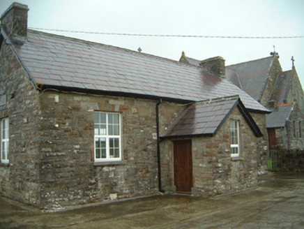 Templeterrace National SchoolSchool · 1252 ydCastleCastle, tower house · 1373 ydCastleCastle, unclassified · 1.9 mi
 Aughris BeachBeach / strand · 3.0 mi
 Aughris HeadHeadland · 3.1 miDonaghHeadland · 3.1 miKnockalongy North-East TopMountain / peak · 3.2 miKnockalongyMountain / peak · 3.2 mi
 Dunmoran StrandBeach / strand · 3.4 mi
Pictures: Andreas F. Borchert, Wikimedia Commons · CC BY-SA 4.0; National Inventory of Architectural Heritage; Michael Dibb, Geograph · CC BY-SA 2.0; Paul Burns, Geograph · CC BY-SA 2.0; Colin Park, Geograph · CC BY-SA 2.0
More archaeology and monuments in County Sligo · All of County Sligo
What do you know about this place?