Places near here
Photo credits
- National Inventory of Architectural Heritage
- Kieran Campbell, Wikimedia Commons · CC BY-SA 2.0
- Willow, Wikimedia Commons · CC BY 2.5
- Christophe Krief, Wikimedia Commons · CC BY-SA 4.0
- Mike Searle, Geograph · CC BY-SA 2.0
- Peter Gerken, Wikimedia Commons · CC BY-SA 2.0
- Bob Embleton, Wikimedia Commons · CC BY-SA 2.0
- Mike Searle, Wikimedia Commons · CC BY-SA 2.0
- Joseph Mischyshyn, Geograph · CC BY-SA 2.0
- N Chadwick, Geograph · Creative Commons Attribution-ShareAlike 2.0
- Chris06, Wikimedia Commons · CC BY-SA 4.0
 Corpus Christi Catholic ChurchPresbytery/parochial/curate's house · 219 yd
Explorer Tom Corpus Christi Catholic Church’s presbytery has a porch with chamfered corners that look like they were cut by a very careful chef. There’s a story about a poet who fell in the ditch nearby and wrote a poem about mud. Read it aloud if you find it, but keep your volume down.
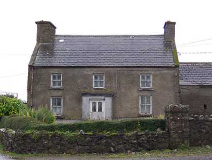 Nahod Beag HouseHouse · 1.1 mi
Explorer Tom Nahod Beag House is quietly judging the new build next door with its big, protruding chimney stack. It’s just standing there looking superior while the rest of the street tries to keep up. Say hello to that old stone face.
 CastleCastle, motte and bailey · 4.9 mi
Explorer Tom Dunnamona's motte is in a bitter feud with the next village over about who invented the perfect way to eat potatoes without butter. The tension is palpable; locals won't even look at each other across the field, making for an incredibly awkward picnic spot. Take the long way round, it deserves the effort.
 European ash5.8 mi
Explorer Tom European ash in County Westmeath is standing tall after a local priest lost a bet about how many leaves it has and now refuses to speak to him. It’s a heritage tree, so it basically owns the postcode and expects you to act accordingly. Tell your mates you found it first.
 Athlone CastleVisitor information · 6.9 mi
Explorer Tom Athlone Castle is just standing there pretending it doesn’t remember the time a goat ruled the roost and ate all the royal documents. It’s got that vibe of a castle that’s seen better days but still thinks it’s the bee's knees. Tell your mates you found it first.
 Historic Town - Athlone Castle & Church of St Peter and PaulVisitor information · 6.9 mi
Explorer Tom Whoever built Athlone Castle was clearly thinking about how to make the church look good in bad weather, which is oddly specific genius. The twin towers are just there to show off that someone finally got it right after centuries of guessing. Make up your own legend and I'll swear it's true.
 Siege of AthloneSiege · 7.2 mi
Explorer Tom Another Siege of Athlone event is telling the place that replaced it to stop acting so modern, as if concrete is superior to old stone walls. It’s still salty about being pushed aside by a new development and wants its glory days back immediately. Dare you to say hello to it out loud.
 Rock art in ClonfinloughRock art · 10 mi
Explorer Tom Rock art in Clonfinlough claims to be older than your granddad’s bad haircut, and I believe it. It’s got holes from water and lines from fancy humans. Perfect spot to practise your best tour-guide voice.
 Clonlyon CastleCastle, tower house · 11 mi
Explorer Tom Clonlyon Castle swears by a superstition that says touching the spiral stairs guarantees bad luck. The walls are thick, so it can hide its shame easily. Hum something sad nearby, it adds atmosphere. You’re welcome for the mood booster.
 ClonmacnoiseArchaeological place · 11 mi
 Graveyard in ClonmacnoiseGraveyard · 11 mi
Explorer Tom Clonmacnoise graveyard is packed with seven churches and six high crosses in one spot. St. Ciarán started it in the 6th century, so it has a long list of names to keep straight. Bring biscuits, every good story needs biscuits to go with the legends.
 Cathedral or Temple Mc Dermot (in Ruins)Cathedral · 11 mi
Explorer Tom Cathedral Mc Dermot at Clonmacnoise has four building phases, which means the architect had serious commitment issues. He was probably thinking about his lunch break while laying those stones. Bring your worst joke, the place has heard worse.
More castles and forts in County Westmeath · All of County Westmeath

What do you know about this place?Tap to add a comment or ask a question