
What is recorded here
Situated on an E-facing slope at the E foothills of the Monavullagh Mountains. It was described as a large slate house with a bawn and outhouses owned by Darby O'Brien of Kilcomeragh castle (WA015-043----) in 1640 (Simington 1942, 78). It featured in the Battle of Comeragh in September 1643 when an English army under…
Read the whole record
From the National Monuments Service (Archaeological Survey of Ireland) record WA023-011001
Places near here
Photo credits
- National Inventory of Architectural Heritage
- Maker not stated on source page, ph.pinterest.com
- Maker not stated on source page, commons.wikimedia.org
- Maker not stated on source page, au.pinterest.com
- Maker not stated on source page, tr.pinterest.com
- PST Sport project photograph; individual photographer not stated, pstsport.com
- Maker not stated on source page, ru.pinterest.com
- Maker not stated on source page, www.pinterest.com
 farm house612 yd
Explorer Tom Farm house in Barnankile nearly got famous when a celebrity spotted it on a nature documentary, but they mistook it for…
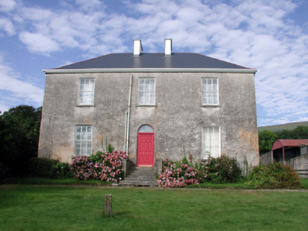 Mount KennedyHouse · 652 yd
Explorer Tom Mount Kennedy is sick of people asking if there’s actually a Kennedy living inside or if it’s just a very confused…
 mill (water)1088 yd
Explorer Tom Mill in Boolattin is holding a long grudge against the weather because of all that rain. It’s a water mill, so it used…
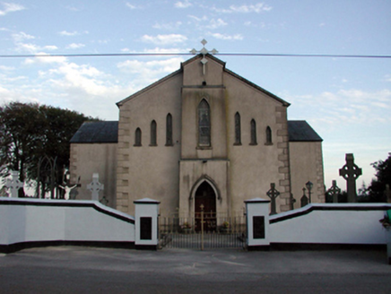 Saint Bridget's Catholic ChurchOfficially recorded historic building · 1203 yd
Explorer Tom Saint Bridget's Catholic Church in Boolattin is standing firm like it’s daring gravity to make a move. It got renovated…
 Church in KnockyelanChurch · 1296 yd
Explorer Tom Church in Knockyelan was once ruled by a goat that decided the fields were its kingdom. It’s unlocated, which is just…
 Standing stone in CurraunStanding stone · 1.0 mi
Explorer Tom Another standing stone in Curraun is guarding a hidden treasure that is definitely just an old biscuit tin. It has a…
 CastleCastle, unclassified · 1.2 mi
Explorer Tom Castle in Gortavicary would put 'emotionally unavailable and structurally unsound' on its dating profile right now. It…
 Standing stone in CarrigmoornaStanding stone · 1.4 mi
Explorer Tom Standing stone in Carrigmoorna is shaped like a diamond, which makes it look like it’s trying to sell itself as jewelry…
 Kilrossanty GAA pitchGAA ground · 1.4 mi
 CairnCairn, clearance cairn · 1.6 mi
Explorer Tom Another Cairn in Ballykilmurry thinks it’s the main event, sitting right at the northeast edge of the rath. It would…
Church in BallynevogaChurch · 1.8 miExplorer Tom Church in Ballynevoga hates visitors who talk too loudly about its non-existence, which is ironic since there’s nothing…
 Comeragh Church of Ireland CemeteryGraveyard · 2.0 mi
Explorer Tom Comeragh Church of Ireland Cemetery claims to be best mates with a local celebrity who visited once in the nineties.…
More historic places in County Waterford · All of County Waterford

What do you know about this place?Tap to add a comment or ask a question