What is recorded here
Situated on a rise in rolling pastureland. Described in the Civil Survey (1654-6) as 'The ruined Castle of Glanehelty ye walls standinge' (Simington 1934, vol. 2, 211). The tower house has been modified and incorporated in later buildings. Alterations included the lowering of the building from a three- or four-storey…
Read the whole record
Situated on a rise in rolling pastureland. Described in the Civil Survey (1654-6) as 'The ruined Castle of Glanehelty ye walls standinge' (Simington 1934, vol. 2, 211). The tower house has been modified and incorporated in later buildings. Alterations included the lowering of the building from a three- or four-storey structure to a two-storey one. The external W face is the only side not blocked by later building, however, it has been completely re-modelled, with original fenestration replaced. This rectangular tower house (dims. 8.8m N-S; 10.5m E-W; wall T 1.4m) appears to be constructed of limestone with dressed quoins - it has an external dashed render and a high base-batter (H 3.45m; W at base 0.4m). The original entrance is on the E side through a pointed doorway with external rebate. The ground floor has been much altered and served as a parlour in the nineteenth century (O'Flanagan 1930, vol. 3, 99). Spiral stairs in the SE angle have been blocked-up between ground and first-floor level. The first-floor level is now directly under a modern roof. Two limestone corbels project from both the E and W walls which would have supported a wooden floor above. At second-floor level the stair is lit by a flat-headed single-light. Vol. 1 - North Tipperary' compiled by Jean Farrelly and Caimin O'Brien (Dublin: Stationery Office, 2002).
From the National Monuments Service (Archaeological Survey of Ireland) record TN015-090
Places near here
Picture notes
- Computer-made picture. It does not show this monument.
- National Inventory of Architectural Heritage
- Computer-made picture. It does not show this mountain top.
- Mike Searle, Geograph · CC BY-SA 2.0
- Computer-made picture. It does not show this playground.
 Fairy fort / earthen ringfort in GlenahiltyFairy fort / earthen ringfort · 391 ydComputer-made picture
 Glenahilty National SchoolSchool · 465 yd
 Enclosure in BantisEnclosure · 985 ydComputer-made picture
 IndicatedBarrow, ring-barrow · 1233 ydComputer-made picture
 Burial ground in BantisBurial ground · 1612 ydComputer-made picture
 Fulacht fia in BantisFulacht fia · 1612 ydComputer-made picture
 Fairy fort / earthen ringfort in MiddlewalkFairy fort / earthen ringfort · 1645 ydComputer-made picture
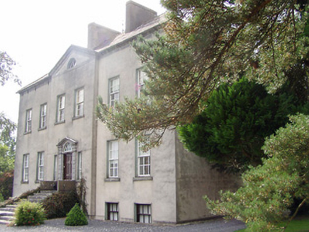 Donnybrook HouseCountry house · 1.1 mi
 ScreggaunMountain / peak · 1.6 miComputer-made picture
 Ballintotty Castle (in ruins)Castle, tower house · 4.3 mi
 Lisbunny CastleCastle, hall-house · 4.8 mi
 Children's playground6.9 miComputer-made picture
More castles and forts in County Tipperary · All of County Tipperary

What do you know about this place?Tap to add a comment or ask a question