What is recorded here
A castle at Ballimackad (63) in Killeagh parish is not depicted on the Down Survey (1656-8) barony or parish maps (http://downsurvey.tcd.ie/) but according to the Civil Survey (1654-6) Christopher Plunkett owned 60 acres there together with the castle and bawn, and 30 cabins (Simington 1940, 272). The location is described as a castle and the site of a castle on the 1836 and 1908 eds of the OS 6-inch map, and is situated on a WNW-ESE esker ridge and c. 80m ESE of the motte (ME008-030----). The area has been quarried and some stone with mortar adhering is the only evidence of a structure.
A castle at Ballimackad (63) in Killeagh parish is not depicted on the Down Survey (1656-8) barony or parish maps (http://downsurvey.tcd.ie/) but according to the Civil Survey (1654-6) Christopher Plunkett owned 60 acres there together with the castle and bawn, and 30 cabins (Simington 1940, 272). The location is described as a castle and the site of a castle on the 1836 and 1908 eds of the OS 6-inch map, and is…
From the National Monuments Service (Archaeological Survey of Ireland) record ME008-031
The monument record does not grant public access. Check the route and ask the landowner before entering private land.
- What survives
- Recorded monument
Places near here
Photo credits
- National Inventory of Architectural Heritage
- Malene Thyssen, Wikimedia Commons · CC BY-SA 3.0
- Kieran Campbell, Geograph · CC BY-SA 2.0
- Britishfinance, Wikimedia Commons · CC BY-SA 4.0
- Mike Searle, Geograph · CC BY-SA 2.0
- Sitomon, Wikimedia Commons · CC BY-SA 2.0
- John M, Wikimedia Commons · CC BY-SA 2.0
- James Fergusson, after E. Conwell, Wikimedia Commons · Public domain
- Bill Griffiths, Wikimedia Commons · CC BY-SA 2.0
Enclosure in Moat (fore By.)Enclosure · 627 yd graveyard/cemetery862 ydEuropean Beech867 ydmill (water)1109 ydCastleCastle, motte and bailey · 1.8 miMullaghmeen ForestPicnic place · 1.8 miMount FortuneMountain / peak · 2.5 miRoss CastleCastle, tower house · 3.7 miEuropean Yew3.9 miLoughcrewMegalithic tomb cemetery · 4.3 miHag's ChairArchaeological place · 4.9 miSlieve Na CalliaghMountain / peak · 5.0 mi
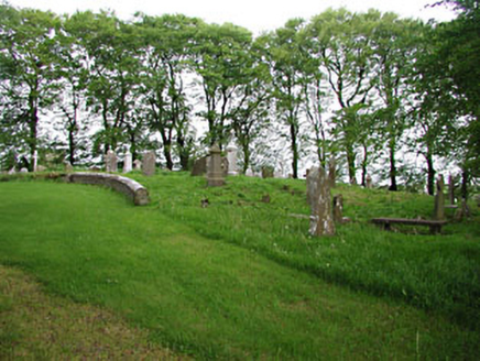 graveyard/cemetery862 yd
 European Beech867 yd
 mill (water)1109 yd
 CastleCastle, motte and bailey · 1.8 mi
 Mullaghmeen ForestPicnic place · 1.8 miMount FortuneMountain / peak · 2.5 mi
 Ross CastleCastle, tower house · 3.7 mi
 European Yew3.9 mi
 LoughcrewMegalithic tomb cemetery · 4.3 mi
 Hag's ChairArchaeological place · 4.9 mi
 Slieve Na CalliaghMountain / peak · 5.0 mi
More castles and forts in County Meath · All of County Meath
What do you know about this place?