
Places near here
Photo credits
- National Inventory of Architectural Heritage
- Alison Cassidy, Wikimedia Commons · CC BY-SA 4.0
- Kmcnamee, Wikimedia Commons · CC BY-SA 4.0
- A.-K. D., Wikimedia Commons · CC BY-SA 4.0
- Colin Park, Geograph · CC BY-SA 2.0
Explorer Tom An Coimín Buí in County Cork is being picked on by the wind because it has a name that sounds like a fancy cheese but…
 Milleeny BridgeBridge · 2.1 mi
Explorer Tom Milleeny Bridge in Murnaghbeg was built on a bargain where the mason got paid in extra-thick rubble walls instead of…
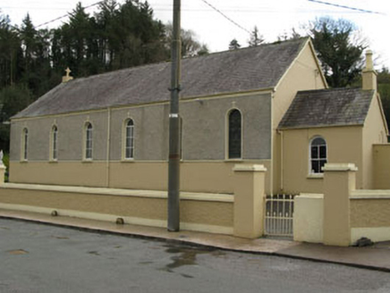 Séipéal Ghobnatan [Saint Gobnet's Catholic Church]Church/chapel · 2.3 mi
Explorer Tom Séipéal Ghobnatan in Murnaghbeg has been standing by the road since 1871. It’s got stained glass that probably sees…
Sli Gaeltacht MuscraiWalking route · 2.7 miExplorer Tom Sli Gaeltacht Muscrai was once tried to be bought by a very determined cow who kept grazing on the signposts. The…
CastleCastle, unclassified · 4.2 miExplorer Tom Castle in Cúil An Mhothair makes the wild claim that it is older than the hills surrounding it, scattered with loose…
 St Gobnets WellHoly well · 4.3 mi
Explorer Tom St Gobnets Well is the final stop on a pilgrimage and has heard every 'Ave' and 'Gloria' since the dawn of time, so…
Cascade WoodWood · 4.4 miExplorer Tom Cascade Wood inspired someone to write a poem that rhymed ‘tree’ with ‘sea’ and then just gave up after two lines…
Castle (Site of)Castle, unclassified · 4.5 miExplorer Tom The Castle in An Sliabh Riabhach is stuck up on a rocky hillock. The O Herlihy clan had a go at building here, but it’s…
European long distance path E8 - part IrelandWalking route · 4.5 miExplorer Tom European long distance path E8 - part Ireland in County Cork is dreaming about winning the lottery and buying a private…
 Naomh Abán GAA pitchGAA ground · 4.6 mi
 CairnCairn, unclassified · 4.9 mi
Explorer Tom St Abbán’s grave at An Tseanchluain is guarding some ogham stones like a grumpy gatekeeper. It’s got a bullaun on top…
 CrohaneMountain / peak · 6.3 mi
Explorer Tom Crohane in County Kerry would write on its dating profile that it’s looking for someone who doesn’t mind a bit of grit…
More mountains and hills in County Cork · All of County Cork

What do you know about this place?Tap to add a comment or ask a question