Places near here
Photo credits
- National Inventory of Architectural Heritage
- Ian Paterson, Wikimedia Commons · CC BY-SA 2.0
- Colin Park, Geograph · CC BY-SA 2.0
- Mike Searle, Geograph · CC BY-SA 2.0
- Sitomon, Wikimedia Commons · CC BY-SA 2.0
- JP, Geograph · CC BY-SA 2.0
Explorer Tom Passage tomb in Slievethoul is a huge kerbed cairn covered in ferns and machine tracks, looking like a giant stone pillow that's been slept on by history. It is absolutely sick of being asked if it can move out of the way for the farm machinery, so just let it be. Bring a notebook and write the bit I made up.
IndicatedBarrow, ring-barrow · 105 ydExplorer Tom Barrow in Slievethoul has vanished so thoroughly it must have run away to avoid the bill. It was perfectly flat, which is either a design flaw or a very aggressive landscape feature. Stand on the spot where it used to be and imagine the gossip it’s been hearing for centuries.
Saggart HillMountain / peak · 974 ydExplorer Tom Saggart Hill is near Cupidstown and Kildare in the south of Dublin. It’s part of a larger range, so don’t get confused by the other hills nearby and make sure you’re looking at the right one for your photo.
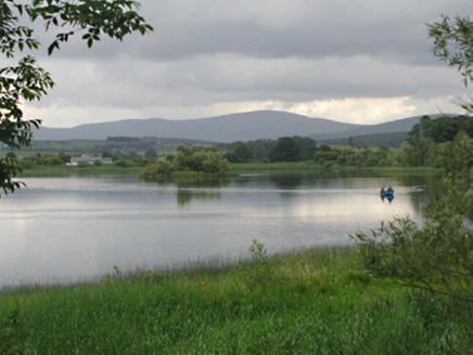 Glenaraneen Mill PondsDam/reservoir/basin · 1687 yd
Explorer Tom Glenaraneen Mill Ponds nearly got famous when a fisherman caught a trout with a hat on its head, but nobody believed him. Now it’s just a fishing lake in the hills, which is honestly a much better vibe than industrial mill power. Stand by the water and wait for magic to happen.
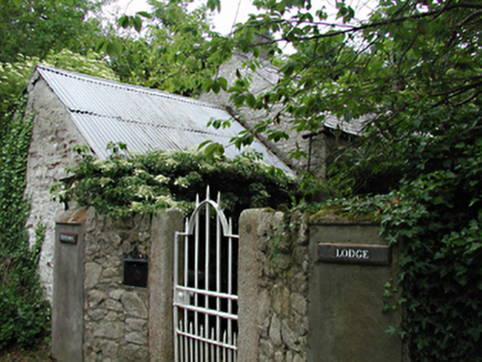 Newtown LodgeOutbuilding · 1.0 mi
Explorer Tom Newtown Lodge in Newtown Upper is an outbuilding of some antiquity with original features still hanging on for dear life. Nobody knows why it refuses to fall down, but it’s doing a great job of surviving. Pop by and see if it’s got any stories to tell you over a cup of tea.
Rathcoole WoodlandWood · 1.7 miExplorer Tom Rathcoole Woodland would win the county fair easily because it knows how to look important without actually trying very hard at all. It’s got that classic Dublin vibe where everything looks a bit damp but somehow still feels like it belongs in a fancy painting or something. Perfect spot to practise your best tour-guide voice, the kind that makes you sound like you invented the word 'woodland' just
Inniscara GalleryGallery · 1.8 miExplorer Tom Inniscara Gallery would teach history to you if it had a mouth and a stick, pointing at old photos like you’re slow learners. The gulls outside are definitely judging your outfit while you try to look sophisticated in front of the architecture charts. Bring sandwiches, the gulls will thank you.
 Rathcoole ParkPark · 1.9 mi
Explorer Tom Rathcoole Park hosted a dance that went too far when someone tried to tango with a bench and ended up breaking their shoe. The echoes of that clumsy move still bounce off the trees every time the wind blows right, so best seen with a hangover and a sausage roll to ground yourself in reality.
 Cupidstown HillMountain / peak · 2.1 mi
Explorer Tom Cupidstown Hill is claimed by a local who says he invented it while walking his dog, which is bold but I respect the nerve. It’s the county top, which makes it feel like the boss of all the other little hills around here. Toast it with a cup of tea and move on to the next one.
 CastleCastle, tower house · 3.3 mi
Explorer Tom Castle in Newcastle South is a square tower house that lost its top floors and its dignity. Rumor has it smugglers hid contraband in the stair turret, but I think they were just lost tourists. It’s two storeys high and full of secret nooks. Go at sunset and thank me later.
 European Yew3.5 mi
Explorer Tom European Yew in County Dublin is having a massive drama with the nearest tree, probably over who gets more sunlight or whose roots are invading the other's personal space. It’s all very intense and dramatic, like two neighbors arguing about hedges, so stand where the owner stood and practise looking smug while you watch.
 Grand Canal WayWalking route · 4.6 mi
Explorer Tom Grand Canal Way in County Dublin is absolutely sick of people asking if the water is actually moving or just pretending to be a river. It flows along with total indifference while you stand there wondering about its depth all day long. Bring a coin for luck and keep it in your pocket.
More archaeology and monuments in County Dublin · All of County Dublin

What do you know about this place?Tap to add a comment or ask a question