What is recorded here
In pasture, located on a low, level elevation, bordered to W and N by wet pasture and overlooked c. 100m to N by a ridge of higher ground. Located at the S end of a broad peninsula of pasture and sand dunes that extends N into Kilalla Bay and is bordered to W by the estuary of the Palmerstown River. This building is…
Read the whole record
From the National Monuments Service (Archaeological Survey of Ireland) record MA015-089
Places near here
Photo credits
- Maker not stated on source page, en.wikipedia.org
- Maker not stated on source page, www.alamy.com
- Maker not stated on source page, www.pinterest.com
- Steve Edge, Geograph · CC BY-SA 2.0
- National Inventory of Architectural Heritage
- N Chadwick, Wikimedia Commons · CC BY-SA 2.0
- N Chadwick, Geograph · Creative Commons Attribution-ShareAlike 2.0
- Maker not stated on source page, commons.wikimedia.org
- Maker not stated on source page, nl.pinterest.com
- Killala GAA Club, via Connaught Telegraph; individual photographer not named, www.con-telegraph.ie
 Church in KillybroneChurch · 1040 yd
Explorer Tom Church in Killybrone has drama with the nearest tree. The church was demolished long ago, but the tree still stands…
 Graveyard in KillybroneGraveyard · 1040 yd
Explorer Tom Graveyard in Killybrone started because two lads bet in the pub they could find a church that wasn't there. O'Donovan…
 Fairy fort / earthen ringfort in CroghanFairy fort / earthen ringfort · 1200 yd
Explorer Tom Fairy fort / earthen ringfort in Croghan is sick of being asked if it's haunted. It becomes an island at high tide, so…
 Rinnaun PointHeadland · 1226 yd
Explorer Tom Rinnaun Point is the center of a local superstition that says if you whistle at it, your car will never start again for…
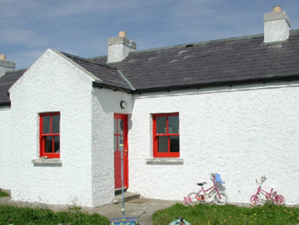 Ross Coastguard StationCoastguard station · 1535 yd
Explorer Tom Ross Coastguard Station is a cottage-like building overlooking Killala Bay, where they used to watch out for ships…
 Templemurry GraveyardCemetery · 1659 yd
Explorer Tom Templemurry Graveyard would survive a zombie attack simply by standing still and letting them trip over all the…
 Templemurry Grave YardGraveyard · 1672 yd
Explorer Tom Templemurry graveyard sits on a hillock where the wind keeps picking on it, whistling through the gaps in its old walls…
 Church in KilgobbanChurch · 1677 yd
Explorer Tom Church in Kilgobban would describe the 1800s to a teenager as 'a time when people walked everywhere and complained…
 CastleCastle, unclassified · 1.0 mi
Explorer Tom The Ross castle is in a feud with the next village over who invented the concept of being lost. It’s known as Rosse Mc…
 Holy well in RossHoly well · 1.0 mi
Explorer Tom This holy well in Ross is half-buried under sand like it's trying to disappear from the map. Saint Patrick would…
 Rathfran AbbeyVisitor attraction · 1.1 mi
Explorer Tom Rathfran Abbey in Mayo has an unlikely celebrity friend who is actually just a very persistent fox that refuses to…
 Gerry Maheady Memorial Park, Killala GAAGAA ground · 2.1 mi
More historic places in County Mayo · All of County Mayo

What do you know about this place?Tap to add a comment or ask a question