
What is recorded here
Seven-arch rubble stone railway viaduct over road, opened 1878, with single-span section to centre. Closed, 1982. Squared rubble limestone walls with batter to north-west, cut-stone stringcourse, and cut-stone coping to parapets. Series of seven round arches on squared rubble stone piers having rusticated cut-stone…
Read the whole record
Seven-arch rubble stone railway viaduct over road, opened 1878, with single-span section to centre. Closed, 1982. Squared rubble limestone walls with batter to north-west, cut-stone stringcourse, and cut-stone coping to parapets. Series of seven round arches on squared rubble stone piers having rusticated cut-stone stringcourses to springs of arches, dressed rubble limestone voussoirs, and squared rubble limestone soffits having traces of lime render over. Single cast-iron span to centre on cast-iron girders having lattice supports with sections of replacement tubular iron railings, c.1950, over. Freestanding railway signal, c.1950, to north-west.
An elegantly-composed railway viaduct, built to designs prepared by James Otway (1843 - 1906) by Smith Finlaysaon and Company, Glasgow, which forms an imposing landmark in the centre of Kilmacthomas. The civil engineering heritage significance of the composition is identified by the form and construction of the arches, which have retained their original profile, together with the central span incorporating early cast-iron work. The construction in squared rubble limestone attests to high quality stone masonry, and produces an appealing textured visual effect in the landscape. The viaduct, one of a pair in the immediate locality (with 22805035/WD-15-05-35), is of particular significance as a reminder of the development of the Great Southern and Western Railway line by the Waterford, Dungarvan, and Lismore Railway Company in the late nineteenth century, which promoted the economy of smaller urban areas, such as Kilmacthomas.
From the Buildings of Ireland (National Inventory of Architectural Heritage) record 22805032
Places near here
Photo credits
- National Inventory of Architectural Heritage
- Hywel Williams, Wikimedia Commons · CC BY-SA 2.0
- Peter Taylor, Wikimedia Commons · CC BY-SA 2.0
- ethics girl, Wikimedia Commons · CC BY-SA 2.0
- ethics girl, Geograph · CC BY-SA 2.0
- Veekrokki, Wikimedia Commons · Public domain
 Historic buildingOfficially recorded historic building · 28 yd
 Ard na GreineSchool · 39 ydBurnt mound in GraigueshoneenBurnt mound · 677 ydSite of ChurchChurch · 754 yd
 Golden HarvestInstallation · 1004 yd
 Croughaun HillMountain / peak · 3.1 miCrough WoodWood · 3.9 miKilclooney WoodForest · 4.0 mi
 Clonea Power CastleCastle · 4.6 mi
 CastleCastle, tower house · 4.6 miSt. Bernard's WellSpring · 5.0 mi
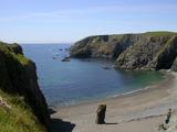 Copper CoastCoastal geological landscape · 5.1 mi
More historic places in County Waterford · All of County Waterford

What do you know about this place?Tap to add a comment or ask a question