What is recorded here
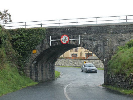
Bridge in Killaghoor carries a railway, but a tiny surveyor’s mark in its limestone gives it the indignity of a child being measured against the kitchen wall. “Stand up straight.” “I’m holding a train.” “Don’t answer back.”
Single-arch railway bridge over road, opened 1866; extant 1897. Repaired. Part creeper- or ivy-covered tuck pointed snecked rock faced limestone walls between tuck pointed snecked rock faced limestone battered piers with replacement mild steel railings on concrete block parapets. Single segmental arch with drag edged rock faced limestone ashlar voussoirs. Sited spanning road on a corner site with unkempt embankments to road.
A bridge identified as an integral component of the mid nineteenth-century civil engineering heritage of the outskirts of Westport on account of the connections with the development of the Mayo Branch of the Midland Great Western Railway (MGWR) line (opened 1866) by the Great Northern and Western Railway (GNWR) Company with the architectural value of the composition confirmed not only by the rock faced surface finish demonstrating good quality workmanship, but also by the elegant "sweep" of the arch making a pleasing visual statement in the streetscape: meanwhile, a discreet benchmark remains of additional interest for the connections with cartography and the preparation of maps by the Ordnance Survey (established 1824).
From the Buildings of Ireland (National Inventory of Architectural Heritage) record 31308804
This does not grant access. Most recorded buildings are privately owned; view them only from public ground unless the owner allows entry.
Places near here
Photo credits
- National Inventory of Architectural Heritage
- John Lucas, Geograph · Creative Commons Attribution-ShareAlike 2.0
- Richard Webb, Geograph · Creative Commons Attribution-ShareAlike 2.0
- Laurel Lodged, Wikimedia Commons · CC0
- Maker named on the Wikimedia Commons picture page · Public domain
- Andreas F. Borchert, Wikimedia Commons · CC BY-SA 4.0
- N Chadwick, Geograph · Creative Commons Attribution-ShareAlike 2.0
- Oliver Dixon, Geograph · CC BY-SA 2.0
- Graham Horn, Geograph · CC BY-SA 2.0
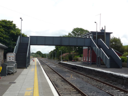 Westport Railway StationFoot bridge · 573 yd
 Westport Railway StationBuilding misc · 598 yd
 Westport Railway StationRailway station · 617 yd
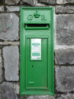 Westport Railway StationPost box · 633 yd
 Westport Railway StationStore/warehouse · 731 yd
 Westport Railway StationTrain shed · 768 yd
 Westport HouseHeritage attraction · 1.4 mi
 Baldcypress1.5 mi
 Round Tower2.5 mi
 Grave YardGraveyard · 2.5 mi
 Brackloon WoodsForest · 3.3 mi
 Crott MountainMountain / peak · 5.3 mi
More historic places in County Mayo · All of County Mayo
What do you know about this place?