
What is recorded here
This graveyard is located in the centre of Aghagower village, at a junction of several roads, which lie directly outside the graveyard walls on the W, N and E sides. The graveyard consist of a subrectangular area (c. 65m N−S; c. 55m E−W) enclosed by a stone-built wall (Wth 0.45m; int. H 0.4-0.8m; ext. H 1.55m) of relatively recent date. It is bordered at S by the present-day Roman Catholic church. Remains dating to the medieval period, which are enclosed within the graveyard, include a round tower (MA088-063003-), a church (MA088-063001-) and a bullaun stone (MA088-063010-). A penitential station (MA088-063004-), known as ‘Labba Patrick’ or Patrick’s Bed, is located at the SE end of the graveyard and was the traditional starting point of a ‘pattern’ or devotional round of prayers, which also visited two holy wells, one (MA088-063005-) located immediately outside the graveyard wall at NW, and the other (MA088-063006-) 7m NNW of the graveyard. The interior ground level of the graveyard is considerably higher than exterior ground level, indicating a build-up of ground level over time. There is a high density of grave plots, the majority marked by inscribed headstones of 19th-and 20th-century date, but interspersed amongst them are simple uninscribed stone gravemarkers.
This graveyard is located in the centre of Aghagower village, at a junction of several roads, which lie directly outside the graveyard walls on the W, N and E sides. The graveyard consist of a subrectangular area (c. 65m N−S; c. 55m E−W) enclosed by a stone-built wall (Wth 0.45m; int. H 0.4-0.8m; ext. H 1.55m) of relatively recent date. It is bordered at S by the present-day Roman Catholic church. Remains dating…
From the National Monuments Service (Archaeological Survey of Ireland) record MA088-063002
The monument record does not grant public access. Check the route and ask the landowner before entering private land.
- What survives
- Recorded monument
Places near here
 Round Tower9 yd
 Abbey in ruinsReligious house, unclassified · 21 yd
 Saint Patrick's Catholic ChurchChurch/chapel · 57 ydCarney's Cottage 1863Memorial · 92 ydFamine MemorialMemorial · 92 yd
 Cross-inscribed pillar in LankillCross-inscribed pillar · 1.7 miIndicatedBawn · 1.8 mi
 Westport HouseHeritage attraction · 3.8 mi
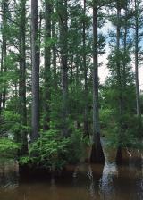 Baldcypress3.9 mi
 Brackloon WoodsForest · 3.9 miPirate QueenHeritage attraction · 4.0 miGarvillaun PointHeadland · 4.5 mi
Pictures: Andreas F. Borchert, Wikimedia Commons · CC BY-SA 4.0; N Chadwick, Geograph · Creative Commons Attribution-ShareAlike 2.0; Ridiculopathy, Wikimedia Commons · CC0; Laurel Lodged, Wikimedia Commons · CC0; Maker named on the Wikimedia Commons picture page · Public domain; Oliver Dixon, Geograph · CC BY-SA 2.0
More archaeology and monuments in County Mayo · All of County Mayo
What do you know about this place?