DDiscover AloneMapAbout

Barrow in Timolin

Barrow, mound barrow
Computer-made picture that does not show Barrow in TimolinNot a photo of this monument
Computer-made picture. It does not show this monument. · Report the wrong picture

The monument record does not grant public access. Check the route and ask the landowner before entering private land.

What do you know about this place?Tap to add a comment or ask a question

What you write will be public.

What is recorded here

This was one of a series of archaeological investigations carried out on the proposed route of the N9 Realignment at Moone-Timolin-Ballitore Hill. TIMOLIN, SITE 43 (designated KD036-047----) proper was a low mound, half of which was on the line of the road, but, as cist burials had previously been found on either side…

Read the whole record
This was one of a series of archaeological investigations carried out on the proposed route of the N9 Realignment at Moone-Timolin-Ballitore Hill. TIMOLIN, SITE 43 (designated KD036-047----) proper was a low mound, half of which was on the line of the road, but, as cist burials had previously been found on either side of the line of the road, it was decided to investigate the entire area (Licence No. 99E0203). The site of a slip road adjoining the present road was also investigated because a further cist grave was said to have been found at the foot of a standing stone near the present road. A geophysical survey of the relevant areas pinpointed a number of potential features, and eight cuttings, 2m x 2m, were dug by hand on the sites indicated. Only one of these showed any structural remains, and that appeared to be a recent feature, near the present road. However, a large amount of medieval pottery was found here in the topsoil. It may be significant that the Fair Green is recorded as having been near here. After the eight cuttings had been excavated, the relevant parts of the route were completely stripped by machine. Two small burnt spreads were found, as well as traces of drains and lazy-beds that had been shown in the geophysical survey. Further medieval pottery was found scattered around the field, presumably spread by ploughing. When Site 43 proper, a low circular mound, was being stripped, a pit burial (designated KD036-047001-) was exposed, and the remainder of the half of the mound to be affected by the road was excavated by hand. A further pit (designated KD036-047002-) and two cists (designated KD036-047003- and KD036-047004-) were found.The first pit, Feature 6, was subrectangular, 1.3m x 0.9m, and 0.2m deep. It contained the remains of a child, five to seven years old. The bones were not burnt but were broken and disarticulated. This appeared to be the result of later disturbance, as some of the bones were found between three overlapping flat stones that had collapsed into the pit. The second pit, Feature 8, was also subrectangular, 1.9m x 1.1m, but the lower part was smaller and almost triangular. The overall depth was 0.43m. Some flat slabs of stone were found near the top. This pit had certainly been disturbed, as only two fragments of cremated bone were found in it, along with part of a clay pipe stem. One cist, Feature 7, comprised four stone slabs forming the walls (1.2m x 0.8m) and a capstone that was somewhat bigger than the cist proper. There was no floor stone. It contained a crouched inhumation, with no grave-goods. The skeleton lay on its right, facing west, with the head at the southern end. It was identified as the remains of a woman aged 25-35. The second cist, Feature 9, was polygonal, with a stone base. No capstone was present, but there was an outer wall of slabs sloping inwards at an angle of about 30o. The cist was shallow, only 0.2-0.23m deep, and was filled with a mixture of soil and cremated bone. Cremated bone was also found beneath the floor stone and between the inner and outer walls. The cremation represented the remains of two adults and one child. They were accompanied by two pots: an upright vase and an undecorated vessel, inverted. The cist proper measured 1.4m x 0.86m; the overall dimensions including the outer walls were 1.6m x 1.4m. (www.excavations.ie)

From the National Monuments Service (Archaeological Survey of Ireland) record KD036-047

Places near here

Photo credits
  • Maker not stated on source page, tr.pinterest.com
  • Maker not stated on source page, www.irishexaminer.com
  • National Inventory of Architectural Heritage
  • Sciadopitys from UK, Wikimedia Commons · CC BY-SA 2.0
  • Maker not stated on source page, www.pinterest.com
  • Maker not stated on source page, commons.wikimedia.org
  • Andreas F. Borchert, Wikimedia Commons · CC BY-SA 4.0
  • Maker not stated on source page, en.wikipedia.org
Standing stone in TimolinStanding stone · 388 yd

Explorer Tom Standing stone in Timolin was removed so long ago we’re just guessing where it went now. It had a little cist under it…

Fairy fort / earthen ringfort in TimolinFairy fort / earthen ringfort · 603 yd

Explorer Tom Fairy fort / earthen ringfort in Timolin is holding a long grudge against the weather for messing up its bank. It’s…
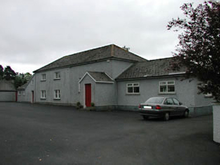
Timolin National SchoolSchool · 721 yd

Explorer Tom Timolin National School has been growing like a fungus, with new bits sprouting every century until it’s basically a…

Saint Mullin's Church (Timolin)Church/chapel · 730 yd

Explorer Tom Saint Mullin's Church in Timolin has a retirement plan involving doing absolutely nothing while looking very dignified…
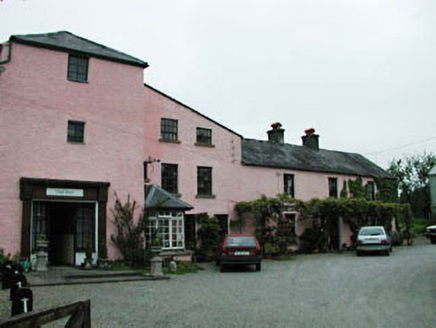
mill (water)748 yd

Explorer Tom Mill in Timolin is still arguing with the village over who owns the sound of the water. It grinds its teeth every time…

handball alley1249 yd

Explorer Tom Handball alley in Moone handles nosey neighbours by hitting the ball directly at their eyes. It’s a rare survival of a…
European Larch1339 yd

Explorer Tom European Larch has an escape plan involving turning completely bare and pretending it’s a shrub in winter. Its first…

Moone Abbey GraveyardGraveyard · 1559 yd

Explorer Tom Moone Abbey Graveyard in County Kildare has had so many names changed that it’s basically a celebrity rebranding agency…

Cross-inscribed stone (present location) in MooneCross-inscribed stone (present location) · 1562 yd

Explorer Tom Cross-inscribed stone in Moone lies by the church with high relief. It has strong opinions on modern buildings and…

Graveyard in MooneGraveyard · 1562 yd

Explorer Tom Graveyard in Moone is where the whole parish once argued about who had the best grave location for three straight days.…

Church (in Ruins)Church · 1562 yd

Explorer Tom Church in Moone smuggled bales of illegal wool through the windows in the 14th century. It’s been around since the 10th…

CastleCastle, tower house · 1607 yd

Explorer Tom Castle in Moone is hiding a scandal that has been simmering for centuries without boiling over. It’s got murder holes…

More archaeology and monuments in County Kildare · All of County Kildare

Add to this placeAdd a picture Add a detailed tip Add a story

Explore the map1,095,414 places to discover

Next place · or swipeStanding stone in Timolin