
What is recorded here
Church in Moone is missing both its belfry and its Lady chapel. That’s an Irish goodbye carried out by sections of the building, with the remaining walls still holding their coats.
This is a multi-period church dating from the 10th/11thC to the 15thC. It is a rectangular structure of uncoursed limestone rubble with a few dressed granite quoins (dims. 28.8m x 5.7m). The E gable (H. 7-8m) has a modern window (possibly similar to the original. Its belfry, which is shown by Cooper in 1784 at the SE corner of the church, fell down in the early nineteenth century and the Lady chapel and N wall were pulled down in the 1830's (JKAS 1895, 292-3). The E end of the N wall is still standing (H. 5m). There are single light splayed windows in the N and S walls. The W gable (H. 8m) has two lintelled windows. There is a lintelled entrance at the W end of the S wall. The church at Moone is first mentioned in 1179, when it was listed within the diocese of Glendalough and was granted to St. Patrick's cathedral in Dublin between 1220 and 1228 (McNeill 1950, 5). A royal visitation of 1615 described it as in good repair, but it was ruinous by 1630 (Arch. Hib. 1941, 51). The high crosses are probably not in their original positions. (Bradley et al. 1986 vol. 4, 332-4)
Date of upload: 5 September 2016
This is a multi-period church dating from the 10th/11thC to the 15thC. It is a rectangular structure of uncoursed limestone rubble with a few dressed granite quoins (dims. 28.8m x 5.7m). The E gable (H. 7-8m) has a modern window (possibly similar to the original. Its belfry, which is shown by Cooper in 1784 at the SE corner of the church, fell down in the early nineteenth century and the Lady chapel and N wall…
From the National Monuments Service (Archaeological Survey of Ireland) record KD036-031001
The monument record does not grant public access. Check the route and ask the landowner before entering private land.
- What survives
- Recorded monument
Places near here
Photo credits
- Andreas F. Borchert, Wikimedia Commons · CC BY-SA 4.0
- Gerd Eichmann, Wikimedia Commons · CC BY-SA 4.0
- National Inventory of Architectural Heritage
- Sciadopitys from UK, Wikimedia Commons · CC BY-SA 2.0
- Willow, Wikimedia Commons · CC BY 2.5
- dougf, Geograph · CC BY-SA 2.0
- Alex Passmore, Wikimedia Commons · CC BY-SA 2.0
 Stone CrossCross, High cross · 22 yd
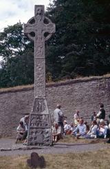 CrossCross, High cross · 26 yd
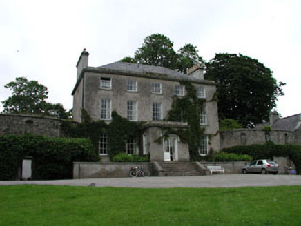 Moone Abbey HouseCountry house · 58 yd
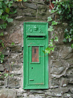 post box141 yd
 European Larch921 ydBurtown House and GardensHeritage attraction · 2.3 mi
 European ash2.8 mi
 Kilkea CastleCastle, tower house · 3.6 miLorcán Ó TuathailMemorial · 3.9 mi
 Castledermot Round TowerHeritage attraction · 4.8 mi
 History of Moat of ArdscullVisitor information · 4.9 mi
 Ardscull MoatCastle, motte · 4.9 mi
More historic places in County Kildare · All of County Kildare
What do you know about this place?