
What is recorded here
From the National Monuments Service (Archaeological Survey of Ireland) record ME044-031
Places near here
Photo credits
- Kmcnamee, Wikimedia Commons · CC BY-SA 4.0
- National Inventory of Architectural Heritage
- Maker not stated on source page, commons.wikimedia.org
- Maker not stated on source page, en.wikipedia.org
- Maker not stated on source page, www.irishamericanmom.com
 Drumree GAAGAA ground · 622 yd
 water pump998 yd
Explorer Tom Water pump in Knockmark has decorative banding that makes it look like a piece of art rather than a water source. It…
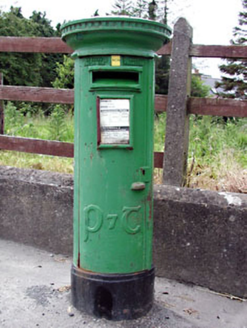 post box1010 yd
Explorer Tom Post box in Knockmark is written in traditional Irish lettering, which makes it feel like a tiny monument to…
 Mapped graveyardGraveyard · 1754 yd
Explorer Tom Mapped graveyard in County Meath would win the county fair just by standing still and looking dignified while everyone…
 Church (in Ruins)Church · 1.0 mi
Explorer Tom Church in Knockmark has a pigeon who refuses to leave. He’s seen more history than most historians, and he’s not…
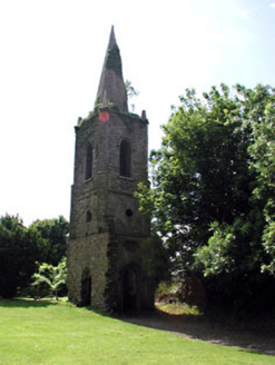 Knockmark ChurchChurch/chapel · 1.0 mi
Explorer Tom Knockmark Church is basically just a tower standing there after the main building got demolished, which is like losing…
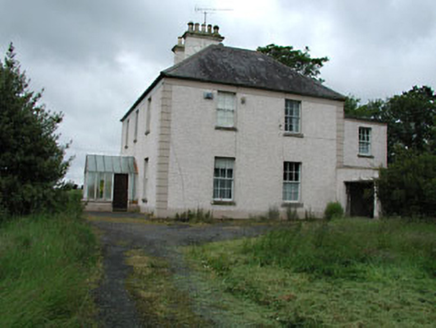 Seachnall HouseFarm house · 1.6 mi
Explorer Tom Seachnall House in Dunshaughlin ended up here because the map had a smudge of jam on it. It’s got timber sash windows…
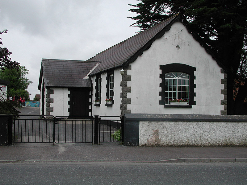 Dunshaughlin National SchoolSchool · 1.7 mi
Explorer Tom Dunshaughlin National School in Dunshaughlin is built on top of a legend about a giant who lost his keys. The 1887 date…
 Fairy fort / earthen ringfort in DunshaughlinFairy fort / earthen ringfort · 1.7 mi
Explorer Tom Fairy fort / earthen ringfort in Dunshaughlin witnessed a love story that ended with someone throwing a shoe. It landed…
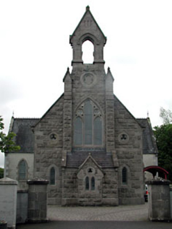 Dunshaughlin LibraryChurch/chapel · 1.7 mi
Explorer Tom Dunshaughlin Library is actually a church that got confused about its career path. It would survive a zombie attack by…
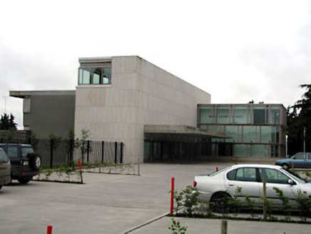 Dunshaughlin Civic OfficesOffice · 1.7 mi
Explorer Tom Dunshaughlin Civic Offices in Dunshaughlin thinks it’s too cool to need heating or cooling, which is bold for an office…
 Enclosure in RathreganEnclosure · 2.2 mi
Explorer Tom Enclosure in Rathregan has a favourite song that’s just the wind whistling through its rectangular walls. It’s small…
More archaeology and monuments in County Meath · All of County Meath

What do you know about this place?Tap to add a comment or ask a question