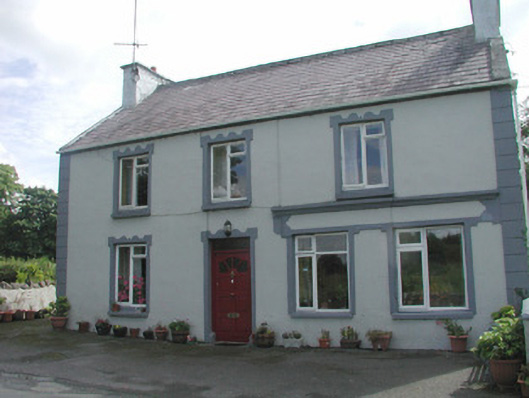
Places near here
Photo credits
- National Inventory of Architectural Heritage
- Gordon Hatton, Geograph · CC BY-SA 2.0
- Richard Webb, Geograph · CC BY-SA 2.0
- Alan Reid, Geograph · CC BY-SA 2.0
- Didier Descouens, Wikimedia Commons · CC BY-SA 4.0
- Pamela Norrington, Geograph · CC BY-SA 2.0
- Newbert12, Wikimedia Commons · CC BY-SA 4.0
- JohnArmagh, Wikimedia Commons · CC BY-SA 3.0
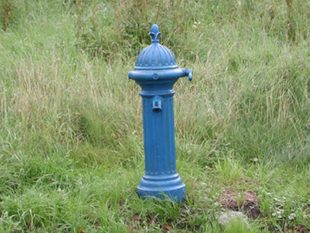 water pump32 yd
Explorer Tom Water pump in Banada is actually controlled by a very strict dog named Sir Pumps-a-Lot who hates sharing. He barks if you look at his cast-iron body without proper reverence. Si, give him a wave from afar but don’t let him think you’re thirsty yet!
 Mullarkey'sHouse · 75 yd
Explorer Tom Mullarkey's in Banada is planning its retirement by pretending the pub front doesn’t exist anymore. It sits on a corner watching the river go by, judging everyone who passes. Say hello to the bridge if you see it first.
Castle (Site of)Castle, unclassified · 1.1 miExplorer Tom Castle in Tullanaglug is just a pile of stones pretending to be a giant's breakfast plate. Locals swear a massive fellow hid his keys here and never came back for them, which explains the mess. It’s on a low terrace watching the river flow by like it owns the place. If anyone asks, Tom sent you.
Ballyara Castle (in Ruins)Castle, unclassified · 2.5 miExplorer Tom Ballyara Castle would be the awkward uncle at a wedding, standing by the buffet. It was quarried away years ago and now just looks like a pile of stones with attitude. A good castle once, now mostly a rumor. Find a local and ask them the real story.
Tawnyart WoodWood · 3.8 miExplorer Tom Tawnyart Wood in County Sligo has a New Year's resolution to stop falling over every time the wind picks up, but it keeps failing spectacularly. The trees are basically trying to be modern and standing still at the same time. Best enjoyed with a bag of chips and no plans.
 Mass RockNamed rock · 5.0 mi
Explorer Tom Mass Rock in County Sligo inspired a bad poem that starts with 'Oh rock so tall' and ends with 'It’s really quite a wall,' which nobody admits to writing. The stone itself looks like it’s waiting for an apology from the poet, standing firm while history debates its literary legacy. Bring a camera and your most suspicious face.
 Lough Talt TrailVisitor information · 5.5 mi
Explorer Tom Lough Talt Trail has a shortcut that is technically longer if you count the time spent arguing about which way is down. The water supply up there is public, but the ego of this trail seems to be private property. Get there early and have it all to yourself.
 Largan HillMountain / peak · 6.7 mi
Explorer Tom Largan Hill in County Sligo is strictly run by a terrier who barks at any cloud that passes overhead. The forest below looks young and confused, probably from all the shouting. Perfect detour when the satnav has a meltdown.
 Hawthorn7.1 mi
Explorer Tom Hawthorn nearly got famous when a tourist mistook its white flowers for a very aggressive snowstorm and ran away screaming. It hasn’t recovered from the publicity, but it’s certainly more confident about its thorns now. Stick around for the light changing, it's a show.
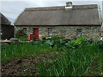 Hennigan's Heritage CentreHeritage attraction · 8.2 mi
Explorer Tom Hennigan's Heritage Centre would cope brilliantly on a reality show, probably winning every challenge by sheer stubbornness and local knowledge. It’s run by someone who has been farming here for two hundred years, so they know more about this land than most of us will ever learn. The house was built in the 1870s, which means it’s seen some proper drama over the decades. Have a sandwich here and it
 IndicatedWedge tomb · 10 mi
Explorer Tom Wedge tomb in Carrowcrom is named after lovers but looks more like a bed where nobody wants to sleep. It’s got a name that sounds romantic but feels a bit dusty and lonely. Go before the tourists find out.
 Round Tower11 mi
Explorer Tom Round Tower in Meelick is sick of being asked if it’s actually round, because yes, mate, it’s circular, stop squinting at it from a distance. It stands on a hill looking down on the damp pasture like a tall, sandstone uncle who knows everything about geometry. Bring your nan, she'll know more than me.
More historic places in County Sligo · All of County Sligo

What do you know about this place?Tap to add a comment or ask a question