What is recorded here
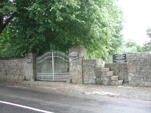
Cemetery laid out, c. 1890. Uncoursed rubble stone boundary wall, concrete coping added c. 1950. Coursed ashlar stone gate piers with cylindrical domed carriage wheel deflectors. Decorative wrought-iron double gates. Stone style to east of gates with stone steeps let into wall thickness. Grass lawns, gravelled paths,…
Read the whole record
Cemetery laid out, c. 1890. Uncoursed rubble stone boundary wall, concrete coping added c. 1950. Coursed ashlar stone gate piers with cylindrical domed carriage wheel deflectors. Decorative wrought-iron double gates. Stone style to east of gates with stone steeps let into wall thickness. Grass lawns, gravelled paths, nineteenth and twentieth century graves marked by low stone plinths with several engraved and carved Celtic crosses. Rubble stone, ivy-covered boundary walls to east, north and west. Fronts to main road.
This cemetery occupies the site of a monastery founded in 1432 but contains no visible traces of it. The roadside wall and gateway, with graveyard behind, provide a pleasing boundary.
From the Buildings of Ireland (National Inventory of Architectural Heritage) record 32403706
Places near here
Picture notes
- Computer-made picture. It does not show this monument.
- Andreas F. Borchert, Wikimedia Commons · CC BY-SA 4.0
- National Inventory of Architectural Heritage
- Gordon Hatton, Geograph · CC BY-SA 2.0
- Richard Webb, Geograph · CC BY-SA 2.0
- Alan Reid, Geograph · CC BY-SA 2.0
- Computer-made picture. It does not show this mountain top.
 Grave YardGraveyard · 9 ydComputer-made picture
 Banada AbbeyReligious house, Augustinian friars · 33 yd
 Stone head in BanadaStone head · 34 ydComputer-made picture
 TombTomb, unclassified · 38 ydComputer-made picture
 bridge84 yd
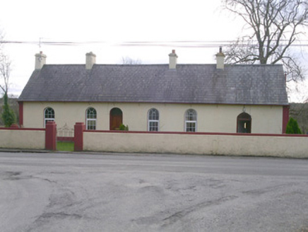 The LodgeGate lodge · 111 yd
 Mullarkey'sHouse · 160 yd
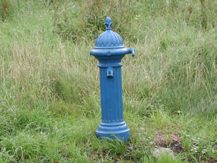 water pump185 yd
 Mass RockNamed rock · 4.9 mi
 Lough Talt TrailVisitor information · 5.4 mi
 Largan HillMountain / peak · 6.6 mi
 MullaghanoeMountain / peak · 7.8 miComputer-made picture
More historic places in County Sligo · All of County Sligo

What do you know about this place?Tap to add a comment or ask a question