DDiscover AloneMapAbout

Abbey in Killeen

Church

What is recorded here

Situated at the SE end of a low NW-SE ridge. This is the location of an early church, the ecclesiastical enclosure of which (ME038-050001-) has been partially excavated (Baker 2009, 57-60). The enclosure consists of two fosses placed c. 12m apart (ext. diam. c. 110m), and the outer had an entrance (Wth c. 4m) at NE,…

Read the whole record
Situated at the SE end of a low NW-SE ridge. This is the location of an early church, the ecclesiastical enclosure of which (ME038-050001-) has been partially excavated (Baker 2009, 57-60). The enclosure consists of two fosses placed c. 12m apart (ext. diam. c. 110m), and the outer had an entrance (Wth c. 4m) at NE, which was dug across later. Six construction and erosion phases were identified, and the outer ditch produced two C14 dates of AD 430-640 and AD 770-980, but the latter might represent a W extension of the enclosure. The inner fosse was slighter and produced a C14 determination of AD 600-810. No physical trace of this church is traceable in the surviving structure, and whether the early church persisted into the second millennium is not known. A second phase of activity saw both ditches cut at SE by the fosse of an Anglo-Norman ring-work castle (ME038-050002-), which may be the re-use of a rath as a C14 date of AD 880-1020 was recovered from the base of the ditch (ibid. 60-1). A church at Killeen is listed in the ecclesiastical taxation (1302-06) of Pope Nicholas IV (Cal. doc. Ire., 5, 255) and Ussher (1622) describes the church and chancel as reasonably repaired (Erlington 1847-064, 1, lxxiv). According to the Dopping (1682-5) and Royal (1693) visitations the church of the Blessed Virgin Mary was ruined since 1641 but the graveyard was fenced (Ellison 1972, 7). The present church was built by Sir Christopher Plunkett, a grandson of Sir Richard Plunkett of Rathregan, in the earlier part of the 15th century (Leask 1960, 13-15). In 1403 Sir Christopher married Joan, the daughter and heiress of Sir Lucas Cusack, and became the lord of Killeen. Their sons are credited with establishing branches of the family at Dunsany, Rathmore, Dunshauglin and Balrath (Baker 2009, 10-15). Sir Christopher and Lady Joan established a chantry within the parish church to pray for their souls in 1431, by which time the church may have been built, and the names of many of its clergy are known. In 1609 the property of the chantry, amounting to over 800 acres and including a stone house in the W end of the churchyard, was vested in the Baron of Killeen. (Cogan 1862-70, 1, 354-7) This is a fortified parish church on the site of the older structure, of which there are no visible remains. It consists of a nave (int. dims 16.85m E-W; 6.8m N-S) and chancel (int. dims 13.9m E-W; 6.1m N-S) that survives complete as a conserved National Monument, although it is within the Killeen estate (Harbison 1970, 187). It is within a D-shaped graveyard (dims c. 50m WNW-ESE; c. 45m NNE-SSW) defined by masonry walls, with the straight side at N where it is bordered by a lane, but excavation (05E0414) found a medieval wall beneath the N lane wall, which may be the original boundary of the graveyard (Baker 2009, 66). The headstones date mainly from c. 1719 to c. 1890, with some later ones. Pointed doorways of a red sandstone towards the W end of the nave walls at N (Wth 1.19m; H 2.33m) and S (Wth 1.2m; H 2.32m) have external hood-mouldings. The impost of the N doorway has some mason’s marks in the form of quartered squares. The S doorway has the base of an added porch (ext. dims 3.82m E-W; 3.28m N-S), which was roofed by John Quatermas and his bedfellow, Ellen Rebne, according to their graveslab in the nave, dated 1570. The long nave walls have single pointed windows of two multi-cusped lights placed E of the doorways, and the W wall has the remains of a cinquefoil triple-light window with dog-tooth decoration on the architrave. The E end of the long nave walls have recesses (L 3.7m; D 0.58m) with flat arches that provide double-light, multi-cusped windows at the ground floor and at the level of the rood loft, but there is only a single ogee-headed light in the N wall at the upper level. The loft is reached by a pointed doorway (Wth 0.57m; H 1.78m) in the N pier of the pointed chancel arch (Wth 3m). The sandstone edges of the piers are chamfered and have eroded. The chancel has three cinquefoil double-light windows in the S wall, of which only the W and E are complete, and there is one similar window at the W end of the N wall. A triple sedelia (L 2.55m; D 0.87m) survives complete between the central and E windows of the S wall. It has cinquefoil ogee-headed openings under a square hood moulding, with a groin-vaulted ceiling. The E window is a three-light cinquefoil window with complete tracery. A pointed doorway (Wth 0.81m; H 1.95m) in the N chancel wall leads to a sacristy (int. dims 4.67m E-W; 3.3m N-S) under an E-W barrel-vault with a rectangular light and fireplace in the N wall and a cinquefoil window in the E wall. The doorway from the chancel also leads to a mural stairs in the W wall of the NE tower (ext. dims 7.2m E-W; 5.27m N-S) and there is a round-headed doorway (Wth 0.88m; H 1.58m) from the foot of this stairs to the outside. The first floor has a light towards the E end of the N wall and a reconstructed window in the E wall, while the S wall has a hagioscope that allows a view into the chancel. A lintelled doorway at the S end of the W wall leads to a mural stairs to the second floor, which has lights in the N and E walls, but there might not have been access to the parapet level. The NE is the largest of four towers at each angle of the church, but the SE tower (ext. dims 2.15m N-S; 2.07m E-W), although it has a corbelled chamber and a square window in the S wall at ground level, is solid masonry. Its only function is to provide communication between the wall-walk on the S chancel wall and that over the E window, which connects with the N wall-walk of the chancel where a section of the parapet survives. From the nave a lintelled doorway at the S end of the W wall leads to a newel stairs in the SW tower (ext. dims 3m E-W; 1.8m N-S) that permits access to the wall-walk on the S wall of the nave. At the top of the tower a doorway leads over the W window of the nave to the belfry stage of the NW tower. This tower (ext. dims 3m E-W; 2.9m N-S) is entered on the ground by a lintelled doorway at the N end of the W nave wall. There are small lights in the N and W walls at ground level, but if there was communication with the first floor it was by internal ladder. The first floor has a corbelled ceiling with three holes for bell-pulls, but the only access to the second floor is by a lintelled doorway from the wall-walk on the N nave wall. The belfry stage has two tall cinquefoil openings on the E and W walls, and one round-headed opening on the N wall. The fragmentary double effigy tomb of a lady and her knight is now reconstructed in the N recess at the E end of the nave (Hunt 1974, 207-08). The table (dims 2.23m x 1.38m; T 0.1m; H over base 0.84m) has a chamfered edge and is carved in false relief, although only the heads survive in trefoil niches with crocketed surrounds. The partial inscription mentions John Cusack, who is unidentified, but it is probably mid-15th century in date. The side-panels might not be related but one long side has five ogee-headed niches with foliate cusps and crockets above, and three surviving crests displaying the arms of Barnwall, Butler or le Poer, and Plunkett impaling Cusack and Tuite quartered. The W end has crests bearing symbols of the Blessed Virgin (a heart pierced by a sword) and symbols of the Passion. There are 12 other graveslabs and memorials that are described separately (Cogan 1862-70, 1, 357-60; FitzGerald 1911; Moore 1970). The octagonal font (ext. dim. 0.66m; H 0.42m; total H 0.92m) with a circular basin (int. diam. 0.51m; D 0.29m) has shallow chamfered under-panels and is located at the W end of the nave. The shaft (H 0.35m) has a cordon at its narrowed waist, and the base is octagonal with a chamfered upper surface (H 0.22m). The rim is damaged, but has a wave-like top and four attachment points for the covering are present. The upper panels were decorated with armorial shields but too faintly to be interpreted now, while o

From the National Monuments Service (Archaeological Survey of Ireland) record ME038-013

This remains an important historical record, but the official description says the monument is no longer visible or has been destroyed. The monument record does not grant public access. Check the route and ask the landowner before entering private land.

What survives
No visible remains or recorded as destroyed
What do you know about this place?Tap to add a comment or ask a question

What you write will be public.

Places near here

Photo credits
  • Thomas Nugent, Geograph · CC BY-SA 2.0
  • C O'Flanagan, Geograph · CC BY-SA 2.0
  • National Inventory of Architectural Heritage
  • C O'Flanagan, Wikimedia Commons · CC BY-SA 2.0
  • Neil Forrester, Co.Meath, Ireland. http://neil.forrester.ie, Wikimedia Commons · CC BY 3.0
  • Patrick Brown, Wikimedia Commons · CC BY-SA 2.0
  • August Schwerdfeger, Wikimedia Commons · CC BY 4.0
  • Matthew Chadwick, Wikimedia Commons · CC BY-SA 2.0
  • Anthony Foster, Geograph · CC BY-SA 2.0
  • Garry Dickinson, Geograph · CC BY-SA 2.0
  • Malene Thyssen, Wikimedia Commons · CC BY-SA 3.0
Killeen CastleCastle, tower house · 89 yd

Explorer Tom Killeen Castle has a curse that only affects people who don't wave when they pass by, so make sure you give it a big thumbs-up from the car window. It’s a tower house sitting on a slight slope, looking like it’s about to tip over into the next county if the wind picks up. The Cussack family probably didn't know what they had until it started growing moss. Find the wonkiest bit and send it

Dunsany CastleGate lodge · 1041 yd

Explorer Tom Dunsany Castle’s gate lodge is the VIP entrance that got tired of the party. It’s full of carved crests but totally disused, which is very on-brand for Meath. Wave at the cows, they’re actually in charge now.

mill (water)1525 yd

Explorer Tom Mill in Clowanstown has one very specific least favourite visitor: the guy who keeps asking why the circular window looks like an eye staring back at him. The slate roof is doing its best to look dignified despite the irregular fenestration giving it away as a bit of a mess. Make a wish, it's had centuries to get bored of your prayers.
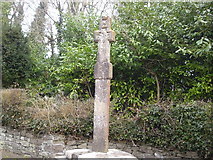
Dunsany CrossCross, Wayside cross · 1614 yd

Explorer Tom Dunsany Cross is like the awkward uncle at a wedding, standing right by the castle entrance and pretending it doesn’t know anyone. It’s made of granite but people used to think it was limestone, which is a classic case of mistaken identity for a two-meter stone. It’s just there on the road, looking rectangular and unimpressed by your outfit. Have a look and decide if I was lying.

Rath MeaveHenge · 2.2 mi

Explorer Tom Rath Meave is a henge that sits on an escarpment near Tara, looking down its nose at everyone who thinks they know what a henge is. It’s got two banks that have never quite agreed on which side to lean, creating a lovely architectural argument. Imagine its opinion of the road leading to it; probably that it’s too busy for casual traffic. Bring a pen pal, they'll be jealous.

Battle of Tara HillBattle · 2.9 mi

Explorer Tom Battle of Tara Hill is still trying to remember if it was a fight or just a very aggressive family gathering. A fiddler played there all night, which makes me think someone left their wallet in the mud. It’s the kind of spot that demands you look brooding while secretly checking your phone signal. Ideal for a moody photo you'll pretend wasn't posed.
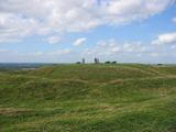
Battle of Tara (Ireland)Major battlefield · 2.9 mi

Explorer Tom Battle of Tara (Ireland) in County Meath has had more names than I have socks in my drawer right now. Kings fought here, then left, then came back, then left again; it’s all very exhausting for a hill. Have a nosey, politely.

Lia Fáil: Hill of TaraLegend location · 3.0 mi

Explorer Tom Lia Fáil: Hill of Tara is a stone with high standards. Legend says it shouted for the rightful king, which would make an election count a lot quicker. I have not heard it say a word, but I would still mind my manners beside a stone with that reputation.

Hill of TaraMountain / peak · 3.1 mi

Explorer Tom Come looking for a king's chair? Bring imagination, not a throne. The Hill of Tara is not one neat royal throne with a handy label. About twenty old monuments are visible here, and surveys and aerial photographs have found at least three times as many again. The Mound of the Hostages is older than the kings in the stories; its passage catches sunrise around Samhain and Imbolc. I would declare myself High King, but the hill would demand better references. Inside the great Enclosure of the Kings are earthworks that make a figure of eight, and the standing stone called the Lia Fáil is traditionally said to roar for the rightful ruler. I gave it a polite chance and heard the wind, which I will take as a firm refusal. The Rath of the Synods suffered damage when searchers hunted here for the Ark of the Covenant in the early twentieth century. Ancient ground can be harmed by very modern certainty. Walk the marked paths and leave every bank and stone where it is. Tara gives you plenty to imagine without moving a grain of it.

Saint Patrick'sMemorial · 3.2 mi

Explorer Tom Saint Patrick's in County Meath has strict rules for visitors, mostly about not tripping over your own feet. It’s a bit shy about being famous for that one statue. Get there early and have it all to yourself before the crowds arrive. The grass is suspiciously green, probably from all the attention.

Skreen CastleCastle, tower house · 3.5 mi

Explorer Tom Skreen Castle is overhearing every secret the walls have swallowed over the centuries and judging your life choices based on them. It got incorporated into an 18th-century house, which is like putting a medieval suit of armor in a modern office; it works, but it's weird. The tower at the corner looks like it's about to lean over and whisper something you didn't want to hear. Have

European Beech5.1 mi

Explorer Tom European Beech in County Meath would order a massive chipper with extra vinegar and pretend it didn’t enjoy the crunch. It’s got a very posh attitude for something growing in mud. Snap one photo, then put the phone away and actually look.

More historic places in County Meath · All of County Meath

Add to this placeAdd a picture Add a detailed tip Add a story

Explore the map1,093,392 places to discover

Next place · or swipeKilleen Castle