Places near here
Photo credits
- Richard Webb, Wikimedia Commons
- National Inventory of Architectural Heritage
- Kenneth Allen, Wikimedia Commons · CC BY-SA 2.0
- Kenneth Allen, Geograph · Creative Commons Attribution-ShareAlike 2.0
- danny kearney, Wikimedia Commons · CC BY-SA 2.0
- Gaelic Life; individual aerial photographer not named, www.gaeliclife.com
- Andreas F. Borchert, Wikimedia Commons · CC BY-SA 4.0
- Wanfried-Dublin, Wikimedia Commons · CC BY-SA 4.0
- Kenneth Allen, Geograph · CC BY-SA 2.0
- Greg Clarke, Wikimedia Commons · CC BY 2.0
 Cruckahenny TrailOfficial walking route · 35 yd
Explorer Tom Cruckahenny Trail takes you from Quigley's Point into the hills above Lough Foyle, and Donegal has arranged the climb…
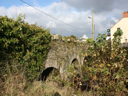 bridge336 yd
Explorer Tom Bridge in Carrowkeel was built around 1780 with three round arches across the Cabry River. An 1837 map shows a corn…
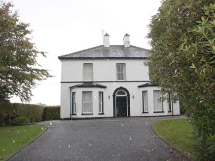 The ManseManse · 355 yd
Explorer Tom The Manse in Carrowkeel was built around 1870 near Greenbank Presbyterian Church. Its front door has a rounded arch…
 Quigley's PointHeadland · 462 yd
Explorer Tom Quigley's Point is where eastern Inishowen leans towards Lough Foyle and Donegal shows it can be quietly fascinating as…
 Greenbank Presbyterian ChurchChurch/chapel · 710 yd
Explorer Tom Greenbank Presbyterian Church dates to 1862, with stained glass set into cast-iron windowwork. I thought the old stone…
 Drung GraveyardBurial ground · 2.4 mi
Explorer Tom Drung Graveyard sits on a plateau above Lough Foyle, hiding the ghost of an old ringfort. The earthworks are mostly…
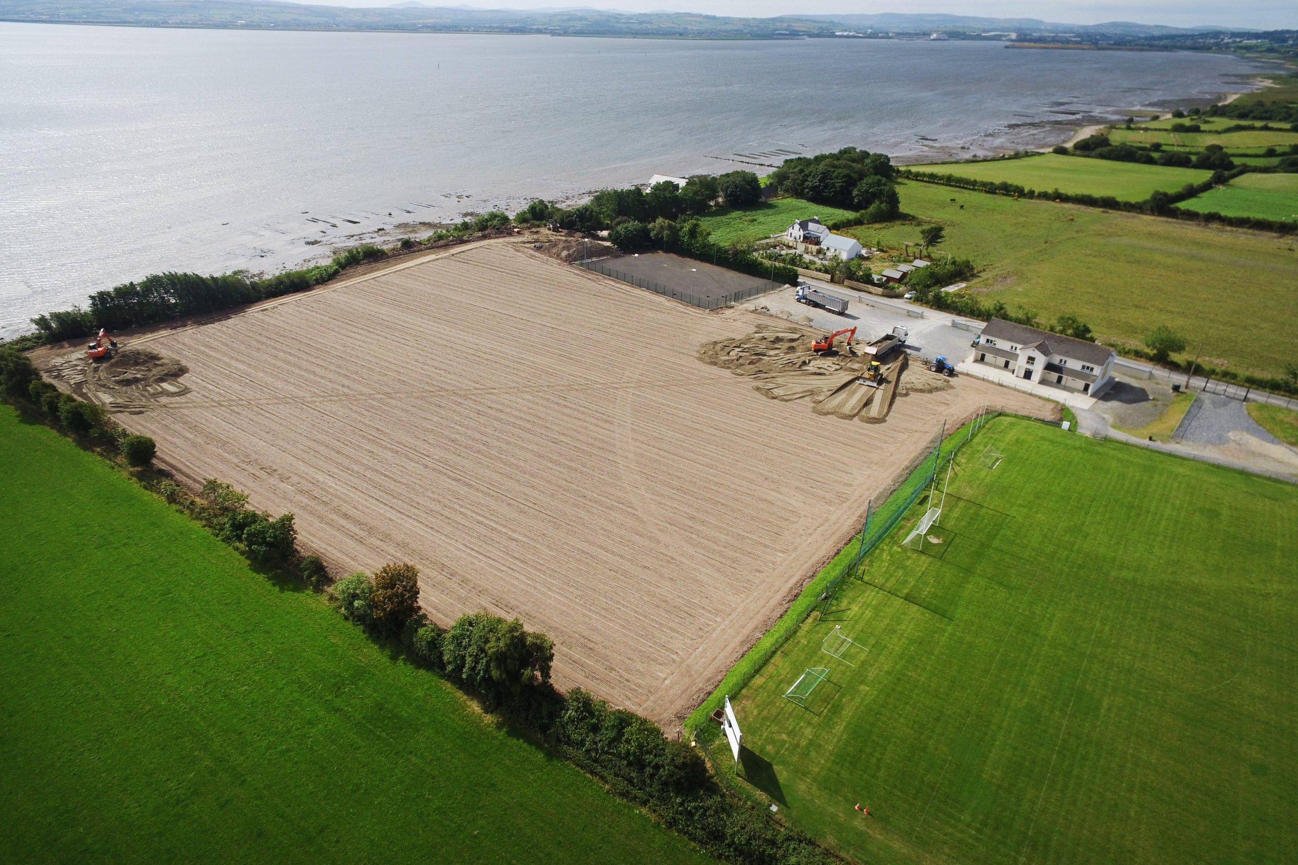 Muff GAA Grounds, Ture, Naomh Pádraig GAA, MuffGAA ground · 2.5 mi
 Eskaheen GraveyardGraveyard · 4.2 mi
Explorer Tom Eskaheen Graveyard lies on high ground looking over Lough Foyle. The earlier survey recorded part of the old church's…
 Eskaheen Portal TombPortal tomb · 4.6 mi
Explorer Tom Eskaheen Portal Tomb carries an enormous five-metre roofstone above its chamber. The slab slipped north, breaking one…
 Squealin' PigPub · 4.8 mi
Explorer Tom Squealin' Pig is hogging the main road so badly the pigs are squealing at the traffic. The next village claims they…
 FinnegansPub · 4.8 mi
Explorer Tom Finnegans sits right next to Squealin' Pig on the main road, sharing the spotlight like stubborn toddlers. Pick one and…
 Muff ForestWoodland walk · 4.9 mi
Explorer Tom Lisnagra Woods near Muff is part of a walk with a name that sounds like the opening of a Donegal legend: Grania's Gap.…
More viewpoints and information in County Donegal · All of County Donegal

What do you know about this place?Tap to add a comment or ask a question