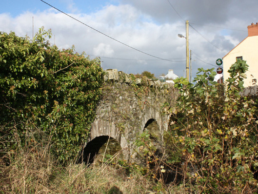
What is recorded here
Triple-arch road bridge spanning the Cabry River, built c. 1780. Round-headed arches with dressed stone voussoirs and smooth rendered soffit. Rubble stone piers with triangular cut-waters to both sides. Rubble stone parapet with rubble stone coping. Double carriageway paved with tarmacadam.
A simple, attractive bridge with fine masonry skills evident in its construction. An extensive mill area is shown on the Ordnance Survey first edition six-inch map of c. 1837 with a corn mill, mill stream and pond, just to the south of the bridge, which no doubt required a good road network for trade. After two centuries of use, its continued use is testament to its design and solid construction.
From the Buildings of Ireland (National Inventory of Architectural Heritage) record 40903007
This does not grant access. Most recorded buildings are privately owned; view them only from public ground unless the owner allows entry.
Places near here
Photo credits
- National Inventory of Architectural Heritage
- Kenneth Allen, Wikimedia Commons · CC BY-SA 2.0
- Kenneth Allen, Geograph · Creative Commons Attribution-ShareAlike 2.0
- danny kearney, Wikimedia Commons · CC BY-SA 2.0
- Andreas F. Borchert, Wikimedia Commons · CC BY-SA 4.0
- Wanfried-Dublin, Wikimedia Commons · CC BY-SA 4.0
- Greg Clarke, Wikimedia Commons · CC BY 2.0
- Richard Webb, Wikimedia Commons · CC BY-SA 2.0
- stuart r hines, Geograph · CC BY-SA 2.0
- Kenneth Allen, Geograph · CC BY-SA 2.0
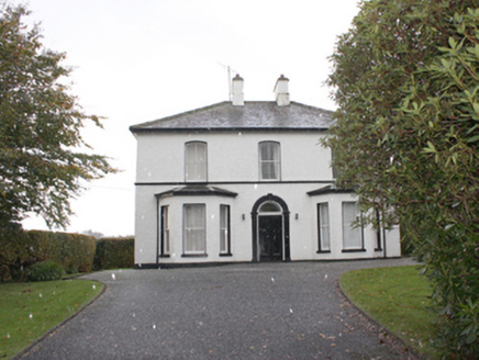 The ManseManse · 345 yd
 Quigley's PointHeadland · 430 yd
 Greenbank Presbyterian ChurchChurch/chapel · 1013 yd
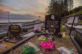 Drung GraveyardBurial ground · 2.3 mi
 CroaghmoreMountain / peak · 4.1 mi
 Eskaheen GraveyardGraveyard · 4.3 mi
.jpg/250px-Eskaheen_(2).jpg "Photo: Wanfried-Dublin, Wikimedia Commons · CC BY-SA 4.0") Eskaheen Portal TombPortal tomb · 4.7 mi
Eskaheen Portal TombPortal tomb · 4.7 mi Muff ForestWoodland walk · 5.1 mi
 Slieve SnaghtMountain / peak · 7.3 mi
 Castle & Earthwork Enclosure: Doherty Tower or Castle Aileach in Elagh MoreCastle & Earthwork Enclosure: Doherty Tower or Castle Aileach · 8.6 mi
 Swann's BridgePicnic place · 9.7 mi
 Inishowen Maritime Museum and PlanetariumMuseum · 9.8 mi
More historic places in County Donegal · All of County Donegal
What do you know about this place?