What is recorded here
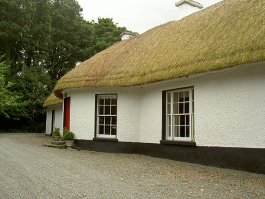
Whiterath Cottage in Whiterath was a hunting lodge with a thatched roof and five chimneys. Five. The family might have spent the day pursuing one fox, but by evening they could have half the county’s weather indoors and still dry it.
Detached six-bay single-storey thatched dwelling, built c. 1750. Rectangular-plan, bowed entrance to north elevation. Straw thatched roof, five painted smooth rendered corbelled chimneystacks. Lime-washed roughcast-rendered walling, painted smooth rendered plinth course. Square-headed window openings, painted smooth rendered patent reveals, painted stone sills, painted timber six-over-six sliding sash windows; tripartite windows to east and west of bow. Square-headed door, painted smooth rendered reveals and soffit, painted timber vertically-sheeted, cast-iron door furniture, two tooled limestone steps to entrance. House set in own grounds, opening onto gravel drive, three-lined avenue leading north-west to road; circular profile rubble stone gate piers to roadway.
This fine thatched house, which served as a hunting lodge for the Fortesque family of Stephenstown House (13901114), presents an early and refined character. The secure dating of such properties is difficult, but it is shown on a local map dated 1777. The survival of mid-eighteenth century detailing to the interior confirms this dating. The house is shown on the first edition OS map, published 1836. The attractive bowed entrance and tripartite windows are a later remodeling as can be seen from the 25" OS map, published 1909. Whiterath is an unusual and appealing property which makes a very valuable contribution to the architectural heritage of Louth.
From the Buildings of Ireland (National Inventory of Architectural Heritage) record 13901201
This does not grant access. Most recorded buildings are privately owned; view them only from public ground unless the owner allows entry.
Places near here
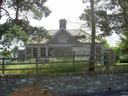 Dromiskin National SchoolSchool · 976 yd
 CastleCastle, tower house · 1128 yd
 Saint Peter's Catholic ChurchChurch/chapel · 1139 ydViking BoatHeritage attraction · 1462 yd
 Round tower in DromiskinRound tower · 1528 yd
 Graveyard1568 ydDrummeenagh HillMountain / peak · 1.7 mi
 Bawn in DarverBawn · 1.9 mi
 Graveyard in Richardstown (ardee By., Richardstown Par.)Graveyard · 5.1 mi
 Monterey Cypress5.1 mi
 Graveyard in StickillinGraveyard · 5.9 mi
 European Beech6.2 mi
Pictures: National Inventory of Architectural Heritage; Garry Dickinson, Wikimedia Commons · CC BY-SA 2.0; Darrin Antrobus, Geograph · Creative Commons Attribution-ShareAlike 2.0; Kieran Campbell, Wikimedia Commons · CC BY-SA 2.0; Garry Dickinson, Geograph · CC BY-SA 2.0; Kieran Campbell, Geograph · Creative Commons Attribution-ShareAlike 2.0; Vadim Manuylov, Wikimedia Commons · CC BY-SA 3.0; Malene Thyssen, Wikimedia Commons · CC BY-SA 3.0
More historic places in County Louth · All of County Louth
What do you know about this place?