What is recorded here
From OpenStreetMap (© OpenStreetMap contributors) w1364093436
Places near here
Photo credits
- National Inventory of Architectural Heritage
- Kieran Campbell, Geograph · Creative Commons Attribution-ShareAlike 2.0
- Garry Dickinson, Geograph · CC BY-SA 2.0
- surrealpenguin, Wikimedia Commons · CC BY-SA 2.0
- Sitomon, Wikimedia Commons · CC BY-SA 2.0
- Bob Embleton, Geograph · CC BY-SA 2.0
- Mike Searle, Geograph · CC BY-SA 2.0
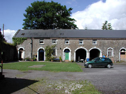 Drewstown HouseStables · 823 yd
Explorer Tom Drewstown House stables are secretly proud of the potato they grew in the old walled garden last year. It was huge, but nobody believes them because it’s just bricks now. Bring a pen pal, they’ll love talking to someone new!
Drewstown LittleMountain / peak · 1270 ydCausey FarmHeritage attraction · 1.0 miBoglandMemorial · 1.0 miFarmaphobiaHeritage attraction · 1.1 mi Catholic Church of the Immaculate ConceptionChurch/chapel · 1.3 mi
Explorer Tom This church has been having a screaming match with the rain for two hundred years. It stands there in Girley looking dignified while the sky absolutely hammers it. Shout 'you're welcome' to the roof on your way past!
 Grave YardGraveyard · 2.7 mi
Explorer Tom Barrow in Bellewstown in Meath is a tiny seven-metre circle on a ridge, barely taller than a toddler. A local hero once saved it from being used as a goat toilet. If it's closed, admire it from the road like a polite stalker.
 CastleCastle, motte · 3.4 mi
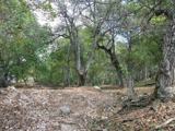 Persian Walnut3.8 mi
 European Yew3.9 mi
 Standing stone in Balnagon UpperStanding stone · 4.1 mi
 Fraine CastleCastle, tower house · 4.6 mi
Explorer Tom Fraine Castle in Fraine would put 'looking for a roof' on its dating profile. It’s got latrine chutes that look like they were added by a mad scientist. Bring sandwiches, the gulls will thank you.
More woods, forests and old trees in County Meath · All of County Meath

What do you know about this place?Tap to add a comment or ask a question