Town defences of Kilmallock (LI047-022----) described in the Urban Survey of County Limerick as following (Bradley et. al. 1989, 155-8); 'The earliest reference to the presence of defences at Kilmallock occurs in a deed, dated by Westropp to the 1280s, which refers to the "communal fosse" as a boundary marker (MacCaffrey 1907, 74). The pipe roll of 1301-2 mentions that the Kilmallock then owed a £14 fine for their account of the murage which suggests that a grant had been made prior to 1300 (38 RDKPRI, 76). In 1375 the town recieved a grant the right of collect murage for ten years in order to enclose the town with a stone wall (Tresham 1828, 98: no. 257) and this was followed by another grant in 1409 (ibid., p. 190: no.55). It is clear from these grants that the walls were being constructed and repaired from the late thirteenth until the early fifteenth centuries. The surviving remains, however, show no distinctive sign of thirteenth century work and appear to belong largely to the late fourteenth and fifteenth centuries. The course of the town wall can be accurately reconstructed from surviving remains and the outline shown on Jones" Elizabethan map of the town (Andrews 1968; TCD, MS 1209/62). The wall is still substantially intact along the west side of the town, particularly from Blossoms Gate to the rear of the modern R.C. church of St. Peter and Paul, where a stretch some 575m long survives. Regrettably, the wall has been taken down in two areas close to Blossom’s Gate in recent times to allow for access to the rear of premises on Sarsfield St. Generally the wall survives in good condition, however, although it is overgrown in places with ivy. Its thickness averages from 1.45 to 1.5m and its surviving height varies from 2 to 5m. The wall consists of a rubble core with external facings. In places, however, the internal facing has been removed and the rubble core exposed. This core is weathering away and there is a real danger that parts of the wall will collapse. The north end is missing but it survives along the back of the properties at the north-east end of Shears St. The wall enclosed the parish church (
LI047-022009-) and portions of the town wall have been observed in the graveyard (
LI047-022010-) wall (Lee 1965, 151). Sections also survive between properties to the south of Wolfe Tone St. Andrews (1968, 27) suggests that a greyish-brown strip illustrated on the Elizabethan map represents a ditch outside the wall. There were five gates of which only one. Blossom’s Gate (Bla-porte), survives today. The others were John’s gate on the north-west, Friar’s Gate on the north, Watergate on the north-east and Ivy gate on the south-west (Andrews 1968; Lee 1965, 150; Westropp 1906-7, 190). Andrews (1968, 35) notes’that the Elizabethan map shows the position of wall towers but no evidence for these survives now. Traces of a seventeenth century earthen bastion can be seen, however, behind SS Peter & Paul’s (RC) Church. There can be little doubt but that "King’s Castle" originally functioned as the entrance to the town on the north-west and that Sheare’s St represents an extension of the medieval town, probably in the sixteenth century. For this reason the account of King’s Castle is included here. Blossom’s Gate
This consists of a three-floored tower with a round arch (partly modernised) spanning the road on the west side of the town. It is built of coursed limestone with long and short quoins. A pointed door on the north west side of the arch provides access to a stairs which is lit by narrow flat lintelled windows. The first floor is lit from the west by a large pointed light with modern surrounds. There is also a small pointed single light with a similar one in the east wall. The second floor or roof level is missing. King’s Castle
Kilmallock was the centre of a manor which appears to have belonged originally to the bishop of Limerick although this was a subject of dispute in the mid-thirteenth century (Sweetman 1875-86, i, nos. 2367, 2386). The castle of Kilmallock is first mentioned in 1206 (ibid., i, no. 289). The site of this first castle is not clear. One would expect that a thirteenth century castle would be a large seigneurial structure and consequently it is difficult to identify it with the fifteenth century "King’s Castle". There can be little doubt that the "King’s Castle", however, is the castle referred to in documents of the late sixteenth and early seventeenth centuries (Westropp 1906-7, 189). It is clearly labelled "Queen’s Castle" on the Elizabethan map of the town (Andrews 1968). This "castle", discussed above, would appear to have begun its life as a gatehouse and was only subsequently adapted to the use of being a royal castle. It was repaired by the Corporation and stood intact until its partial destruction in 1690-91 (Lee 1965, 150). The remains, which spanned St Johns' St., consist of a three-floored structure with base batter and protruding rectangular stair turret, lit by small rectangular slits, on the north-east. It is built of coursed limestone with long and short quoins and a pointed arch over the street. The
modern street is diverted around the tower. There is a chamber to the west of the arch at ground floor level which was lit from north and south by rectangular windows with rectangular hood moulds (possibly inserted and now blocked) while the first floor was lit from the north by a small single light pointed window and from the south by two wide pointed openings. A similar arrangement occurs on the floor above although there is a large rectangular opening in the south wall. A drainage course occurs above this floor and the tower had stepped merlons'. Town Wall described by Thomas (1992, 132-6) as following; 'W wall, 525m, from S gate almost to NW corner; E wall, 150m from NE corner and about same length at the church, which is also the N wall of the grave yard; S wall, an isolated few meters in mid-section, now difficult to see. These stretches vary from 1—2m in height, cemented on top usually, and beyond them are lower remnants embedded in new walls. Gate—Blossoms, S, a tall structure with broad flat-topped central part and narrow slit window over high rounded archway, sufficiently wide for single traffic; one flanking tower survives, slightly higher and rounded (on outside); similar to Clock Gate, Youghal, prior to later 18th century redesigning (Fleming 1914, sketch 18—considered by him to be 'scarce older than 17th century; photographs—Westropp 1916 and Shaffrey 1975, 95)—this or another gate may feature on the corporation seal, dated 1585 but possibly remade 1720—30 (Armstrong 1914). Fosse—partly natural provided by R. Loobagh on E side especially in bridge area, and by lake to W; possible remains of fosse along N half of W wall. Other Fortifications—triangular earthen ditch and platform beyond fosse near NW corner, possibly remains of 17th century earthworks (
LI047-022070-). The street plan of Kilmallock is clearly related to its elongated, rectangular walled shape and its 4 main gates, one on each wall but 3 of them concentrated in the S half. The town is one street deep except by the river's E bend where it is a less confined site. There, are the parish church and two streets which give access to it from the main and Water streets. One of these is shown on the 1600 map as sub-mural, lined by houses, but Andrews (1968, 33) regards this as a distortion of the present Orr St. A similar, but only other short sub-mural street (now gone), is shown on the 1600 map at Blossoms gate. It may have been part of the 'common carte lane' of the Civil Survey. It may also have been more extensive within the town generally, as a sub-mural access lane to both the burgage plots and the wall. At the more detailed level there is a widening of the street immediately outside both Blossom and Ivy gates, and a slight bend in the street beyond the former (at Gortboy House) where the suburban or external gate was (1600 map).
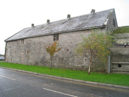 creamery109 yd
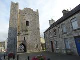 King John's CastleCastle · 147 yd
 Kings CastleCastle, tower house · 147 yd
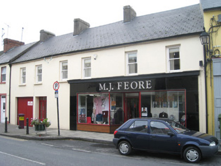 M.j. FeoreHouse · 150 yd
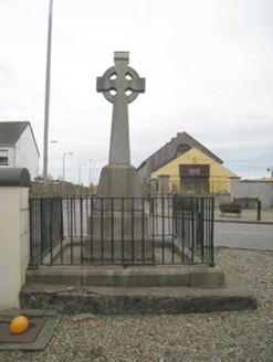 1798 MonumentMonument · 152 yd
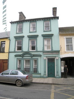 Historic buildingOfficially recorded historic building · 160 yd
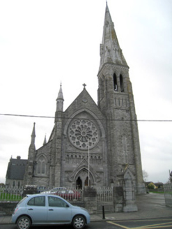 Catholic Church of Saint Peter and Saint PaulChurch/chapel · 321 yd
 Ivy CottageHouse · 337 yd
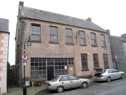 school346 yd
 bridge381 yd
 Kilmallock GAA pitchGAA ground · 445 yd
 Site of Castle CooteHouse, 17th/18th century · 539 yd

What do you know about this place?Tap to add a comment or ask a question