What is recorded here
Situated on a gentle NE-facing slope overlooking a stream to the NE. An unenclosed spring; according to the OS Letters (O'Flanagan 1928, 50-51) a pattern was formerly held here.
From the National Monuments Service (Archaeological Survey of Ireland) record WI044-004
The monument record does not grant public access. Check the route and ask the landowner before entering private land.
- What survives
- Recorded monument
Places near here
Photo credits
- National Inventory of Architectural Heritage
- Jonathan Billinger, Wikimedia Commons · CC BY-SA 2.0
- Sarah777 at English Wikipedia, Wikimedia Commons · Public domain
- Maker named on the Wikimedia Commons picture page · CC BY-SA 2.5
- Miguel Angel Masegosa Martínez, Wikimedia Commons · CC BY 2.0
Enclosure in KillavenyEnclosure · 615 ydEnclosure in ToberpatrickEnclosure · 821 yd Barnadown HouseGates/railings/walls · 1322 yd(Site of) Raymond CastleCastle, unclassified · 1473 yd1798 MemorialMemorial · 1709 ydKilpipe ChurchChurch/chapel · 1.2 mi1798 Lacey Brothers MemorialMemorial · 2.3 mi(Site of) Castle & RampartCastle, unclassified · 2.6 miMonalee HillMountain / peak · 3.0 miAnnagh HillMountain / peak · 3.0 miSessile Oak3.8 miSweet Chestnut4.4 mi
 Barnadown HouseGates/railings/walls · 1322 yd(Site of) Raymond CastleCastle, unclassified · 1473 yd1798 MemorialMemorial · 1709 yd
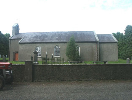 Kilpipe ChurchChurch/chapel · 1.2 mi1798 Lacey Brothers MemorialMemorial · 2.3 mi(Site of) Castle & RampartCastle, unclassified · 2.6 mi
 Monalee HillMountain / peak · 3.0 mi
 Annagh HillMountain / peak · 3.0 mi
 Sessile Oak3.8 mi
 Sweet Chestnut4.4 mi
More archaeology and monuments in County Wicklow · All of County Wicklow
What do you know about this place?