What is recorded here
From the National Monuments Service (Archaeological Survey of Ireland) record DG069-009
Places near here
Photo credits
- Maker not stated on source page, ru.pinterest.com
- Maker not stated on source page, www.flickr.com
- Kenneth Allen, Wikimedia Commons · CC BY-SA 2.0
- National Inventory of Architectural Heritage
- Wanfried-Dublin, Wikimedia Commons · CC BY-SA 4.0
- Maker not stated on source page, commons.wikimedia.org
- Richard Webb, Wikimedia Commons · CC BY-SA 2.0
- Maker not stated on source page, en.wikipedia.org
- Kenneth Allen, Geograph · CC BY-SA 2.0
 Drumkeen Old GraveyardBurial ground · 215 yd
Explorer Tom Drumkeen Old Graveyard is subcircular, a shape that whispers of ancient origins. St. Brigid’s holy well sits just two…
 Standing stone in Lettermore (lettermore Ed)Standing stone · 574 yd
Explorer Tom Standing stone in Lettermore is gone, but the spot was high up overlooking a river valley. I imagine the stone just…
 Newtown BridgeBridge · 917 yd
Explorer Tom Newtown Bridge looks like it swallowed a whole hill just to get its arch wide enough for the Deele River. I reckon the…
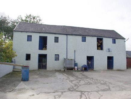 barn1.6 mi
Explorer Tom Barn in Magheracorran has a grand external staircase leading straight up to its first-floor door. I bet the farmer…
 Standing StonesPortal tomb · 1.7 mi
Explorer Tom Standing Stones near Cloghroe keeps two portal stones and a backstone in the survey account. Fagan recorded that…
 Magheracorran Children's Burial GroundChildren's burial ground · 1.8 mi
Explorer Tom Magheracorran Children's Burial Ground was marked as a Caldragh on an older map. The survey found no surface features…
 kiln1.9 mi
Explorer Tom Kiln in Meenavoy has a hidden message carved into its stones that only the very hungry can read. It’s not much more…
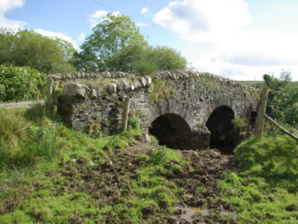 bridge2.2 mi
Explorer Tom Bridge in Aughkeely crosses the Deele River on three little arches, with V-shaped cutwaters on both sides of its piers.…
 Megalithic tomb in KnockagarranMegalithic tomb · 2.4 mi
Explorer Tom Megalithic tomb in Knockagarran is a confused jumble of slabs perched above the Deele River valley. Experts can’t even…
 Battle of GlenmaquinBattle · 4.4 mi
Explorer Tom Battle of Glenmaquin would tell its younger self to stop caring so much about the Crown victory and just enjoy the mud…
 Mapped cemeteryCemetery · 4.6 mi
Explorer Tom Mapped cemetery thinks the local sheep are its best critics, always grazing on the fresh green bits while offering zero…
 Gorey HillMountain / peak · 5.1 mi
Explorer Tom Gorey Hill stands in County Donegal as a mountain peak with its access details completely unknown. The name sounds like…
More archaeology and monuments in County Donegal · All of County Donegal

What do you know about this place?Tap to add a comment or ask a question