DDiscover AloneMapAbout

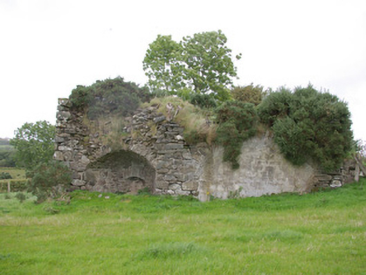
Kiln in Meenavoy

Kiln
Kiln in Meenavoy
Photo: National Inventory of Architectural Heritage · Report the wrong picture

This does not grant access. Most recorded buildings are privately owned; view them only from public ground unless the owner allows entry.

What do you know about this place?Tap to add a comment or ask a question

What you write will be public.

What is recorded here

Freestanding single-bay lime kiln on rectangular-plan, erected c. 1820, having two single-bay barrel-vaulted storage sheds attached to the rear elevation (north). Tapers outwards towards base. Now out of use. Constructed of roughly coursed rubble stone masonry with roughly squared quoins to the corners.…

Read the whole record
Freestanding single-bay lime kiln on rectangular-plan, erected c. 1820, having two single-bay barrel-vaulted storage sheds attached to the rear elevation (north). Tapers outwards towards base. Now out of use. Constructed of roughly coursed rubble stone masonry with roughly squared quoins to the corners. Segmental-headed opening to front (south) having recessed oven aperture with splayed jambs. Former loading chamber on ovoid/circular-plan having rubble masonry construction; chamber now partially collapsed. Two attached barrel-vaulted single-bay sheds to the rear having segmental-headed arches with roughly dressed voussoirs. Earthen embankment to site, now denuded. Set into slope adjacent to small rural road. Former quarry to the south-east.
This interesting former lime kiln, probably erected during the first half of the nineteenth-century (on Ordnance Survey first edition six-inch map of c. 1836), survives in relatively good condition and retains its early character. This particular lime kiln is notable for the two attached barrel-vaulted storage sheds, which were probably used to store limestone and/or lime, or to break up the rocks for insertion in the oven. This structure is well-built using local rubble stone masonry with roughly dressed voussoirs to the arches. The barrel-vaulted roofs are of some technical merit. The embankment to the rear, now denuded, was built/modified to allow for the easy loading of stone through an opening in the roof structure, while the aperture to the front was used to fire the oven to burn the stone and produce lime. Lime kilns appear to have come into popular use in Ireland during the eighteenth century and were a very common feature in the rural landscape up until the first decades of the twentieth century. They were used to burn limestone to produce lime, which was used as an agricultural fertilizer and spread on agricultural land, or in construction as a mortar and a render. Lime was also used for lime-washing buildings, particularly farm buildings, as it was regarded as a cleansing agent at the time. This lime kiln was probably in use by a local farmer and probably provided lime to small farmers etc. in the immediate environs. There is a small quarry a short distance to the south-east where the stone used in this kiln was formerly sourced. There were a number of limes kilns in the immediate environs of this site up until the early-twentieth century (Ordnance Survey twenty-five inch map of 1904), including one immediately to the east (not investigated/viewed). Small rural lime kilns started to go out of common usage during the late nineteenth-century with the advent of industrial-scale lime production facilities and improvements in the transport network, particularly the development of the railways. This simple feature is an interesting feature in the rural landscape to the west of Convoy, and is an appealing and unassuming element of the agricultural/industrial and social heritage of County Donegal.

From the Buildings of Ireland (National Inventory of Architectural Heritage) record 40906923

Places near here

Photo credits
  • Wanfried-Dublin, Wikimedia Commons · CC BY-SA 4.0
  • Maker not stated on source page, www.flickr.com
  • Maker not stated on source page, en.wikipedia.org
  • Kenneth Allen, Wikimedia Commons · CC BY-SA 2.0
  • Maker not stated on source page, storage.googleapis.com
  • National Inventory of Architectural Heritage
  • Maker not stated on source page, ru.pinterest.com
  • Maker not stated on source page, www.letsgoireland.com
  • Kenneth Allen, Geograph · CC BY-SA 2.0
  • Richard Webb, Wikimedia Commons · CC BY-SA 2.0
Standing StonesPortal tomb · 1563 yd

Explorer Tom Standing Stones near Cloghroe keeps two portal stones and a backstone in the survey account. Fagan recorded that…

Standing stone in Lettermore (lettermore Ed)Standing stone · 1.6 mi

Explorer Tom Standing stone in Lettermore is gone, but the spot was high up overlooking a river valley. I imagine the stone just…

Burial ground in Meenagrauv (stranorlar Ed)Burial ground · 1.6 mi

Explorer Tom Burial ground in Meenagrauv is a soggy, semi-circular stone wall sitting in very wet rushy pasture. The east half still…

Newtown BridgeBridge · 1.7 mi

Explorer Tom Newtown Bridge looks like it swallowed a whole hill just to get its arch wide enough for the Deele River. I reckon the…

Fairy fort / earthen ringfort in Backlees,dunwileyFairy fort / earthen ringfort · 1.7 mi

Explorer Tom Fairy fort / earthen ringfort in Backlees, Dunwiley had an inner bank, a lower terrace, a ditch and another bank. The…
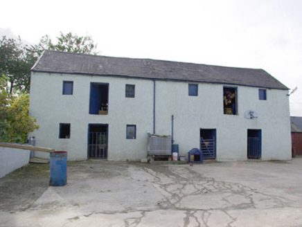
barn1.8 mi

Explorer Tom Barn in Magheracorran has a grand external staircase leading straight up to its first-floor door. I bet the farmer…

Drumkeen Old GraveyardBurial ground · 1.8 mi

Explorer Tom Drumkeen Old Graveyard is subcircular, a shape that whispers of ancient origins. St. Brigid’s holy well sits just two…
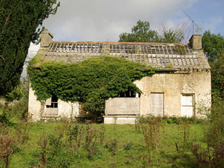
Tyrcallen HouseHunting/fishing lodge, house · 1.8 mi

Explorer Tom Tyrcallen House was built by Sir Henry Steward in the late 1700s as a hunting lodge. It’s derelict now, but it retains…
Fairy fort / stone ringfort in Creggan (stranorlar Ed)Fairy fort / stone ringfort · 1.9 mi

Explorer Tom The fairy fort / stone ringfort in Creggan has vanished completely, leaving only a memory on old maps near a cashel.…

Gorey HillMountain / peak · 3.6 mi

Explorer Tom Gorey Hill stands in County Donegal as a mountain peak with its access details completely unknown. The name sounds like…

Three TopsMountain / peak · 4.7 mi

Explorer Tom Three Tops refuses to fall down because it believes if it loses one top, the other two will start a bitter argument…

Battle of GlenmaquinBattle · 6.2 mi

Explorer Tom Battle of Glenmaquin would tell its younger self to stop caring so much about the Crown victory and just enjoy the mud…

More historic places in County Donegal · All of County Donegal

Add to this placeAdd a picture Add a detailed tip Add a story

Explore the map1,095,414 places to discover

Next place · or swipeStanding Stones