
What is recorded here
From the National Monuments Service (Archaeological Survey of Ireland) record DG069-008
Places near here
Photo credits
- Maker not stated on source page, www.flickr.com
- Kenneth Allen, Wikimedia Commons · CC BY-SA 2.0
- Wanfried-Dublin, Wikimedia Commons · CC BY-SA 4.0
- National Inventory of Architectural Heritage
- Maker not stated on source page, commons.wikimedia.org
- Maker not stated on source page, ru.pinterest.com
- Richard Webb, Wikimedia Commons · CC BY-SA 2.0
- Maker not stated on source page, en.wikipedia.org
- Kenneth Allen, Geograph · CC BY-SA 2.0
 Standing stone in Lettermore (lettermore Ed)Standing stone · 367 yd
Explorer Tom Standing stone in Lettermore is gone, but the spot was high up overlooking a river valley. I imagine the stone just…
 Newtown BridgeBridge · 708 yd
Explorer Tom Newtown Bridge looks like it swallowed a whole hill just to get its arch wide enough for the Deele River. I reckon the…
 Standing StonesPortal tomb · 1.6 mi
Explorer Tom Standing Stones near Cloghroe keeps two portal stones and a backstone in the survey account. Fagan recorded that…
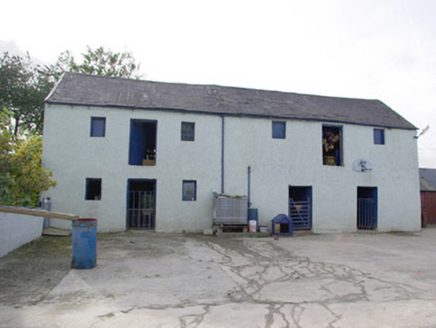 barn1.7 mi
Explorer Tom Barn in Magheracorran has a grand external staircase leading straight up to its first-floor door. I bet the farmer…
 kiln1.8 mi
Explorer Tom Kiln in Meenavoy has a hidden message carved into its stones that only the very hungry can read. It’s not much more…
 Magheracorran Children's Burial GroundChildren's burial ground · 1.8 mi
Explorer Tom Magheracorran Children's Burial Ground was marked as a Caldragh on an older map. The survey found no surface features…
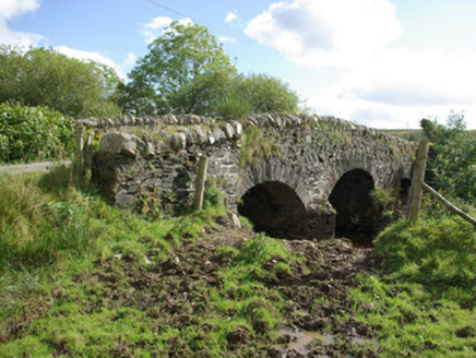 bridge2.1 mi
Explorer Tom Bridge in Aughkeely crosses the Deele River on three little arches, with V-shaped cutwaters on both sides of its piers.…
 Megalithic tomb in KnockagarranMegalithic tomb · 2.4 mi
Explorer Tom Megalithic tomb in Knockagarran is a confused jumble of slabs perched above the Deele River valley. Experts can’t even…
 Bullaun stone in DooballaghBullaun stone · 2.5 mi
Explorer Tom Bullaun stone in Dooballagh is waiting for its full story to be told, as the details are still being gathered. It’s…
 Battle of GlenmaquinBattle · 4.5 mi
Explorer Tom Battle of Glenmaquin would tell its younger self to stop caring so much about the Crown victory and just enjoy the mud…
 Mapped cemeteryCemetery · 4.6 mi
Explorer Tom Mapped cemetery thinks the local sheep are its best critics, always grazing on the fresh green bits while offering zero…
 Gorey HillMountain / peak · 5.0 mi
Explorer Tom Gorey Hill stands in County Donegal as a mountain peak with its access details completely unknown. The name sounds like…
More archaeology and monuments in County Donegal · All of County Donegal

What do you know about this place?Tap to add a comment or ask a question