What is recorded here
Situated on a level low-lying landscape. It is described as 'Tober Lasair' in gothic script on the 1834 and 1907 editions of the OS 6-inch map. It survives as a natural spring surrounded by stones with the foundations of a small structure (dims c. 1m square) immediately to the W. St. Lasair was a female saint about whom little is known but whose pattern was held on 18th of April (Ó Riain 2011, 392). In the folk tradition Lasair has become masculine. Pilgrimages were still taking place here on the first Sundays of May and August in 1937 (IFC Schools MSS 931, 7-8, 11, 373), for which see this web-page accessed on 11/12/2017: https://www.duchas.ie/en/cbes/4758584/4756632 The well is no longer in use.
Situated on a level low-lying landscape. It is described as 'Tober Lasair' in gothic script on the 1834 and 1907 editions of the OS 6-inch map. It survives as a natural spring surrounded by stones with the foundations of a small structure (dims c. 1m square) immediately to the W. St. Lasair was a female saint about whom little is known but whose pattern was held on 18th of April (Ó Riain 2011, 392). In the folk…
From the National Monuments Service (Archaeological Survey of Ireland) record MO028-114
The monument record does not grant public access. Check the route and ask the landowner before entering private land.
- What survives
- Recorded monument
Places near here
Enclosure in DonaghmoyneEnclosure · 437 yd Donaghmoyne HouseGate lodge · 1019 ydMannan Castle (in ruins)Castle, Anglo-Norman masonry castle · 1061 ydGrave YardGraveyard · 1139 ydSaint Patrick's Church (Donaghmoyne)Church/chapel · 1143 ydTobernagalliaghSpring · 1.5 miHorse-chestnut1.9 miEuropean Beech2.7 miKnockreaghMountain / peak · 4.3 miCastleCastle, motte and bailey · 4.5 miFincarn HillMountain / peak · 4.9 miGully IslandIslet · 5.1 mi
 Donaghmoyne HouseGate lodge · 1019 yd
 Mannan Castle (in ruins)Castle, Anglo-Norman masonry castle · 1061 ydGrave YardGraveyard · 1139 yd
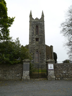 Saint Patrick's Church (Donaghmoyne)Church/chapel · 1143 ydTobernagalliaghSpring · 1.5 mi
 Horse-chestnut1.9 mi
 European Beech2.7 miKnockreaghMountain / peak · 4.3 miCastleCastle, motte and bailey · 4.5 miFincarn HillMountain / peak · 4.9 miGully IslandIslet · 5.1 mi
Pictures: National Inventory of Architectural Heritage; Kieran Campbell, Geograph · CC BY-SA 2.0; Stephan van Helden, Wikimedia Commons · CC BY-SA 4.0; Malene Thyssen, Wikimedia Commons · CC BY-SA 3.0
More archaeology and monuments in County Monaghan · All of County Monaghan
What do you know about this place?