What is recorded here
An irregular-shaped graveyard (map dims. c. 105m N-S; c. 60m E-W) with a church (MO028-116001-) depicted on 1st ed. OS 6-inch map immediately NW of centre but indicated as 'Church Site of' on the subsequent ed. Church reputedly founded by Victor, who was made its bishop by St. Patrick. Shrine of St Adamnan removed from here in AD 830. Rebuilt in 1641 after being ruinous in 1622. No visible surface traces. (Leslie 1929, 175-6, 289)
Reference:
Leslie, J.B. 1929 Clogher Clergy and Parishes. Printed Enniskillen.
An irregular-shaped graveyard (map dims. c. 105m N-S; c. 60m E-W) with a church (MO028-116001-) depicted on 1st ed. OS 6-inch map immediately NW of centre but indicated as 'Church Site of' on the subsequent ed. Church reputedly founded by Victor, who was made its bishop by St. Patrick. Shrine of St Adamnan removed from here in AD 830. Rebuilt in 1641 after being ruinous in 1622. No visible surface traces. (Leslie…
From the National Monuments Service (Archaeological Survey of Ireland) record MO028-116002
The monument record does not grant public access. Check the route and ask the landowner before entering private land.
- What survives
- Recorded monument
Places near here
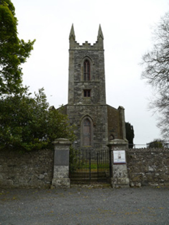 Saint Patrick's Church (Donaghmoyne)Church/chapel · 41 yd
 Donaghmoyne HouseGate lodge · 301 yd
 Mannan Castle (in ruins)Castle, Anglo-Norman masonry castle · 993 ydTobernagalliaghSpring · 1.9 mi
 Horse-chestnut2.3 mi
 European Beech3.0 miKnockreaghMountain / peak · 4.2 mi
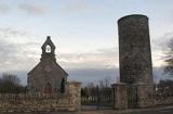 Round Tower4.6 miIndicatedCastle, motte and bailey · 4.6 miFincarn HillMountain / peak · 5.1 miGully IslandIslet · 5.5 mi
 Rath in DrummuckRath · 6.4 mi
Pictures: National Inventory of Architectural Heritage; Kieran Campbell, Geograph · CC BY-SA 2.0; Stephan van Helden, Wikimedia Commons · CC BY-SA 4.0; Malene Thyssen, Wikimedia Commons · CC BY-SA 3.0; Cathar11, Wikimedia Commons · CC0; Eric Jones, Geograph · Creative Commons Attribution-ShareAlike 2.0
More archaeology and monuments in County Monaghan · All of County Monaghan
What do you know about this place?