Places near here
Photo credits
- Eric Jones, Geograph · CC BY-SA 2.0
- Chris Andrews, Wikimedia Commons · CC BY-SA 2.0
- James O'Neill, Wikimedia Commons · CC BY-SA 4.0
- Eric Jones, Geograph · Creative Commons Attribution-ShareAlike 2.0
- National Inventory of Architectural Heritage
 SlievenaboleaMountain / peak · 1330 yd
Explorer Tom Slievenabolea would write 'seeks someone to match my height, no drama' on its dating profile, but nobody checks that far up the mountainside. It’s seen from behind Moyry Castle, which means it’s basically a background extra in someone else’s photo shoot. Take the long way round, it deserves the effort.
 Ring of Gullion Way - Section 3Walking route · 1391 yd
Explorer Tom Ring of Gullion Way - Section 3 had an incident where a fox took charge and directed traffic with its tail. The views are stunning, provided you can ignore the fox's lingering judgment. Ideal stop for a big stretch and a bigger yawn.
 TievecromMountain / peak · 1.1 mi
Explorer Tom Tievecrom had a watchtower called Romeo 23 up top, which sounds like a code name for a very confused romantic spy mission. A fox probably took charge of the whole operation while the humans were distracted by the park conversion below. Mind the nettles, they're the real guards here.
 Moyry CastleCastle · 1.1 mi
Explorer Tom Moyry Castle is small enough for me to claim I could run the whole place, though the soldiers of 1601 would have laughed me out of the gate. Lord Mountjoy built it late in the Nine Years' War to control Moyry Pass, the old Gap of the North. The three-storey tower is nearly square, about eight metres each way, with musket loops in three walls and fireplaces on the fourth. A little bawn enclosed it. Captain Anthony Smith was left with twelve men to guard the crossing. I would have asked for at least thirteen, preferably one who could cook. Check current access to this protected ruin and stay off unstable stone. Stand outside and look along the pass. Its small size makes sense once you see the narrow route it watched.
 Castle & bawn: moyry or moiry castle in CarrickbroadCastle & Bawn: Moyry or Moiry Castle · 1.1 mi
Explorer Tom Castle & bawn: moyry or moiry castle in Carrickbroad is currently stuck in a furious legal dispute with the fairies over who gets to park their tiny chariots in the courtyard first. It’s just a tower house fragment, but the vibes are thick with ancient grudge and mossy mystery. Stick around for the light changing, it's a show.
 Battle of Moyry PassBattle · 1.1 mi
Explorer Tom Battle of Moyry Pass in County Armagh was mostly a fairy dispute over who gets the premium parking spot on the hill. They still argue about it today, actually. Find the wonkiest bit and send it to your group chat immediately.
Battle site: moyry pass, 1600 in CarrickbroadBattle Site: Moyry Pass, 1600 · 1.2 miExplorer Tom Battle site: moyry pass, 1600 in Carrickbroad is where a priest lost a bet to a monk about who could march faster. The priest still owes him a pint. Ideal stop for a big stretch and a bigger yawn.
Battlefield in CarrickaneenaBattlefield · 1.2 miExplorer Tom Battlefield in Carrickaneena is having a massive row with the wind, who keeps screaming insults it doesn't understand because there's no one left to argue back. It’s basically just angry grass now. Stand there long enough and someone will ask if you're lost.
 Ring of Gullion WayWalking route · 1.3 mi
Explorer Tom Ring of Gullion Way is secretly best friends with a famous rock band, which is why the acoustics are so weird. It swears the mountain hums their greatest hits when nobody is looking. Ideal for a moody photo you'll pretend wasn't posed.
 Kilnasggart inscribed stoneArchaeological place · 1.4 mi
Explorer Tom Kilnasggart inscribed stone would get 'Finally, some text I can read' on its tombstone because everything else in the area is just vague nonsense. It’s the oldest Christian-era inscription in Ireland, which makes it the senior member of a very exclusive club. Ring your granny and tell her where you are.
 Kilnasaggart Inscribed Pillar Stone & Cemetery with 6 Cross-carved Stones: Cell Na Sacart in EdenappaKilnasaggart Inscribed Pillar Stone & Cemetery with 6 Cross-carved Stones: Cell Na Sacart · 1.4 mi
Explorer Tom Kilnasaggart Inscribed Pillar Stone in Edenappa is Ireland’s oldest inscribed stone, basically the original influencer. If it were at a wedding, it’d be the uncle who won’t stop talking about history. Toast it with tea and move on.
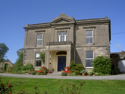 Claret Rock HouseHouse · 1.6 mi
Explorer Tom Claret Rock House is getting roasted by seagulls who think it looks too fancy for its own good. The render is heavy, which makes it look like it’s wearing a wetsuit. Go now, before it gets famous.
More woods, forests and old trees in County Armagh · All of County Armagh

What do you know about this place?Tap to add a comment or ask a question